The European Centre for Medium-Range Weather Forecasts (ECMWF) is globally recognized for its highly accurate, medium-range atmospheric modeling. Their April 1 ensemble runs delivered a striking warning to the meteorological community. The models project that sea surface temperatures in the critical Niño 3.4 region could surge to +2.5°C above the historical average by October 2026.
🎬 Watch our Web Story: El Niño 2026: Record Strength Forecast & USA Impact Guide
Even more alarming, multiple model iterations push this anomaly past the +3°C threshold. If these projections verify, this event would match or potentially surpass the devastating 1997-1998 “Super El Niño.” This sudden departure from the current weak La Niña represents a massive release of oceanic heat into the atmosphere.
To comprehend the magnitude of a Record-Strength El Niño 2026, we must look beyond isolated weather events and examine the systemic mechanisms driving them. The weakening of the easterly trade winds allows warm surface water, typically pooled in the western Pacific, to slosh eastward toward South America.
Table of Contents
How ECMWF Models Detect El Nino Precursors in the Pacific Ocean
The European Centre for Medium-Range Weather Forecasts maintains what many atmospheric scientists consider the world’s most sophisticated ensemble prediction system, and its ability to detect and forecast El Nino development has improved dramatically over the past two decades. Understanding how ECMWF’s models identify El Nino precursors helps explain both the confidence with which seasonal forecasters issue their outlooks and the irreducible uncertainty that makes probabilistic language essential in communicating those outlooks to decision-makers and the public.
El Nino development begins in subsurface ocean layers months before sea surface temperature anomalies become apparent. Warm water accumulates below the surface in the western Pacific during La Nina periods, building what oceanographers call the warm water volume or recharge phase of the ENSO cycle. ECMWF’s coupled ocean-atmosphere model captures this subsurface warming through data assimilation from the Argo float network, moored buoys along the equatorial Pacific, and satellite altimetry that infers subsurface conditions from sea surface height measurements. As this warm subsurface water migrates eastward along the thermocline, the model detects the characteristic eastward propagation of Kelvin waves that precedes El Nino surface expression by weeks to months.
Atmospheric precursors provide complementary predictive signals. Westerly wind bursts in the western equatorial Pacific anomalously strong surface winds blowing toward the east rather than the prevailing easterly trade winds create downwelling Kelvin waves that deepen the thermocline eastward and contribute to El Nino development. ECMWF’s high-resolution atmospheric component captures these wind bursts with considerably greater fidelity than models of a decade ago, enabling more accurate simulation of the coupled ocean-atmosphere feedbacks that characterize El Nino development.
The Madden-Julian Oscillation interacts with El Nino development in ways that create both opportunities for improved forecasting and sources of uncertainty. Strong MJO events generate westerly wind bursts that can accelerate El Nino development when ocean conditions are primed for El Nino, or trigger La Nina development when conditions favor that state. ECMWF’s extended-range forecast system, which provides probabilistic guidance out to 46 days, has demonstrated meaningful skill in predicting MJO evolution, and this skill transfers to some degree to ENSO forecasting on sub-seasonal timescales. However, MJO activity contains inherent predictability limits that propagate into ENSO forecasts, particularly at lead times beyond two to three months when MJO-ENSO interactions become the dominant source of forecast uncertainty.
Global Impacts of a Record-Strength El Nino 2026 Event
If the ECMWF forecast for a record-strength El Nino in 2026 verifies, the global teleconnections typically associated with strong El Nino events would manifest at scales potentially unprecedented in the instrumental record. El Nino’s global reach operates through atmospheric bridge mechanisms: anomalous Pacific sea surface temperatures alter the Walker Circulation and Hadley Cell, reshaping atmospheric wave patterns that influence weather and climate across remote regions thousands of kilometers from the Pacific source region.
Agricultural systems represent one of the most economically significant pathways through which El Nino impacts propagate globally. Strong El Nino events historically correlate with drought across Australia, India, southern Africa, and parts of Southeast Asia. These agricultural breadbaskets produce significant portions of global food commodities, and simultaneous multi-regional crop failures driven by a single El Nino event can trigger food price spikes with cascading effects on global food security. The 1997-98 El Nino, previously the strongest on record, contributed to crop failures across multiple continents and remains a benchmark for agricultural El Nino impact assessment.
For the United States, a record-strength El Nino would likely enhance winter precipitation across the southern tier from California through the Gulf Coast states, providing drought relief to regions that have experienced persistent water stress. California’s snowpack, which provides approximately one-third of the state’s water supply, responds strongly to El Nino’s influence on winter storm tracks. The 2022-23 El Nino-influenced winter delivered exceptional snowpack to the Sierra Nevada following years of drought, demonstrating the magnitude of El Nino’s hydrological influence on western water systems.
The Atlantic hurricane season response to El Nino represents a significant but sometimes misunderstood teleconnection. Strong El Nino events typically suppress Atlantic hurricane activity by increasing upper-level westerly winds that create wind shear inimical to hurricane development. This suppression effect, while statistically robust over many seasons, does not guarantee an inactive season in any given year. Some of the most destructive Atlantic hurricanes have occurred during El Nino years, particularly in the Gulf of Mexico and Caribbean where local sea surface temperature anomalies can counteract the shear-enhancing influence of El Nino under some configurations.
Decision-Making Under El Nino Uncertainty: Agriculture, Water, and Policy Applications
The practical value of ECMWF’s El Nino forecasts depends critically on how decision-makers translate probabilistic seasonal outlooks into concrete actions under uncertainty. Unlike deterministic weather forecasts that specify what will happen at a particular time and place, seasonal climate forecasts provide probability distributions over possible outcomes, and acting effectively on these probabilities requires frameworks for decision-making under uncertainty that many institutions have not yet fully developed.
Agricultural applications demonstrate both the potential and the challenges of seasonal climate forecast use. Farmers who understand El Nino’s typical influence on their regional precipitation patterns can adjust planting decisions, crop variety selection, and irrigation planning based on seasonal outlook information. In regions with strong El Nino teleconnections and reliable forecasts, studies have documented significant economic value from forecast use, particularly for decisions that have long lead times such as perennial crop management and irrigation infrastructure planning.
Water resource managers face a similar challenge of translating uncertain seasonal outlooks into reservoir operating decisions, drought contingency planning, and long-term infrastructure investment. Western US water managers learned from the 2012-16 California drought that relying on historical climate averages for reservoir operations leaves systems vulnerable to extended drought periods beyond historical experience. Incorporating ENSO state and El Nino probability information into reservoir operating rules and drought trigger thresholds represents a meaningful improvement over purely historical approaches, though the inherent uncertainty in seasonal climate forecasts must be explicitly incorporated into these decision frameworks.
Policy applications of El Nino forecasts extend to disaster risk finance and humanitarian preparedness. Forecast-based financing mechanisms pioneered by the Red Cross and Red Crescent Societies automatically release funds for pre-disaster preparedness activities when forecasts exceed specified probability thresholds. These mechanisms transform seasonal climate forecasts into financial triggers that enable humanitarian organizations to act before rather than only after disasters, potentially saving lives and reducing recovery costs. The development and refinement of these forecast-based finance instruments represents one of the most innovative applications of improved El Nino forecasting capability to real-world risk reduction.
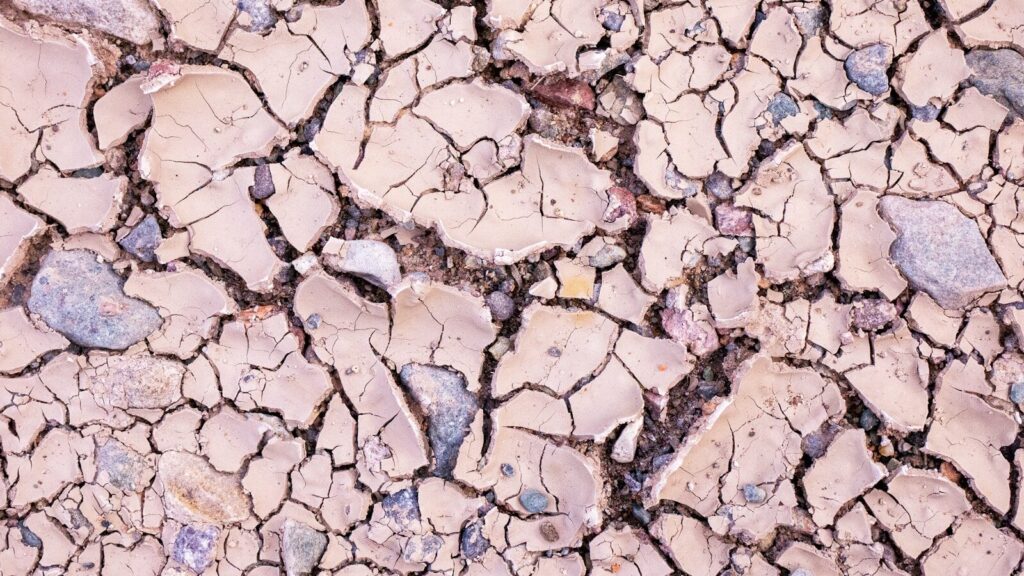
Deep cracks in parched soil demonstrate the severe agricultural realities of global weather extremes. A Record-Strength El Niño 2026 will severely test agricultural resilience in regions prone to sudden precipitation deficits.
Prolonged moisture deficits drastically reduce crop yields and stress local economies.
Global Climate Impacts and Ecological Economics
When the Pacific Ocean warms to these extreme levels, it permanently alters the global atmospheric circulation, known as the Walker Circulation. This thermodynamic shift acts as a domino effect, triggering complex feedback loops across different continents.
The economic fallout from these interconnected climatic events is immense. We must view these disruptions not just as weather phenomena, but as foundational shocks to global ecological economics. For related insights into how shifting oceans alter trade, see our comprehensive analysis on marine ecosystems.
Pacific Flooding and Indonesian Droughts
The immediate epicenter of El Niño’s wrath is the Pacific basin. As warm water migrates eastward, massive convective thunderstorms follow it. This shift pulls vital rainfall away from the western Pacific and dumps it onto the central and eastern regions.
- Indonesia and Australia: These nations will likely face crippling droughts, heightening the risk of catastrophic wildfires and threatening global palm oil and wheat supplies.
- Central Pacific and South America: Conversely, coastal regions of Peru and Ecuador brace for torrential floods, threatening infrastructure and the highly lucrative anchoveta fisheries.
These opposing extremes perfectly illustrate the zero-sum nature of global moisture distribution during major El Niño events.
Agricultural Shifts and Northern Hemisphere Extremes
Further north, the atmospheric wave patterns dictated by the Pacific warming will heavily influence the United States and Europe. The Record-Strength El Niño 2026 is forecasted to inject a powerful subtropical jet stream across the southern and central United States.
This typically results in much wetter summer conditions for the U.S. Midwest. While some moisture is beneficial, excessive rainfall can delay planting seasons and rot root systems, challenging agricultural output. Meanwhile, the Atlantic hurricane season is expected to be remarkably quiet, as El Niño generates hostile upper-level wind shear that tears apart developing tropical cyclones.
Europe faces a vastly different threat profile. The altered jet stream patterns frequently trap high-pressure “blocking domes” over the continent. This setup suggests that hotter, more prolonged European heatwaves are highly probable, stressing energy grids and increasing heat-related mortality rates.
Data Summary: Projected Regional Impacts
To better visualize these shifting dynamics, the following table compares typical weak La Niña conditions against the severe disruptions expected from the upcoming atmospheric shift.
| Global Region | Current State (Weak La Niña) | Projected Impact (El Niño 2026) | Economic Sector at High Risk |
| Indonesia / Australia | Above-average rainfall | Severe drought and high wildfire risk | Agriculture, Mining, Forestry |
| U.S. Midwest | Variable to dry summers | Unseasonably wet, high flood risk | Corn & Soybean Commodities |
| Tropical Atlantic | Highly active hurricane season | Suppressed storm development | Coastal Real Estate, Insurance |
| Western Europe | Moderate summer temperatures | Extreme, prolonged heatwaves | Energy Grids, Public Health |
| South America (West) | Cool waters, dry coasts | Torrential rains, fisheries collapse | Commercial Fishing, Infrastructure |
Why the Record-Strength El Niño 2026 Matters Systemically
While climate models from the National Oceanic and Atmospheric Administration also indicate warming, the ECMWF’s aggressive +3°C runs highlight a crucial vulnerability in our global systems. We are transitioning from a prolonged period of oceanic cooling directly into a massive heating phase.
This whipsaw effect leaves ecosystems and economies dangerously little time to adapt. In the context of broader ecological economics, an extreme El Niño acts as a threat multiplier. It exacerbates existing supply chain bottlenecks, drives up global food inflation, and stresses water resources in regions already grappling with baseline climate shifts.
For a deeper dive into how policy must adapt to these rapid changes, review our latest systemic overview on climate legislation.
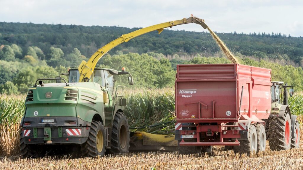
A tractor working through a dense crop field highlights the need for advanced agricultural resilience. Farmers must monitor ECMWF climate models closely to prepare for the heavy rains expected from a Record-Strength El Niño 2026.
Predictive climate data is becoming the most vital input for modern agricultural success.
Preparing for the Record-Strength El Niño 2026
Uncertainty remains a factor in all meteorological forecasting. However, the sheer consensus among leading atmospheric models requires immediate proactive measures. Waiting for the ocean temperatures to peak before acting guarantees economic losses.
- Commodity Markets: Traders and buyers must secure futures and diversify supply lines for crops vulnerable to both droughts (coffee, palm oil) and floods (midwestern grains).
- Infrastructure Management: European municipalities must audit their electrical grids to withstand the cooling demands of extreme heatwaves.
- Water Conservation: Regions facing drought must implement aggressive water retention strategies long before the seasonal rains fail.
Understanding the “Why” behind the Record-Strength El Niño 2026 empowers leaders to move from reactive disaster management to proactive resilience planning. The heat trapped in the Pacific is a physical reality; how our global systems absorb that shock depends entirely on our preparation today.
📖 Related: 7 Terrifying Facts: America’s Extreme Weather Escalation | Polar Vortex Forecast: The Science Behind the Phenomenon
🌠 Also see: Solar activity affects more than just Earth’s climate — it also drives aurora displays across North America. During this solar maximum period, aurora sightings are reaching further south than usual. Discover how to see the northern lights in the USA in 2026 and the upcoming sky events calendar for 2026–2027.
Water Footprint Impact Calculator
Measure direct and virtual water consumption across household, agricultural, and industrial supply chains against regional watershed stress metrics.
Calculate Water Footprint →