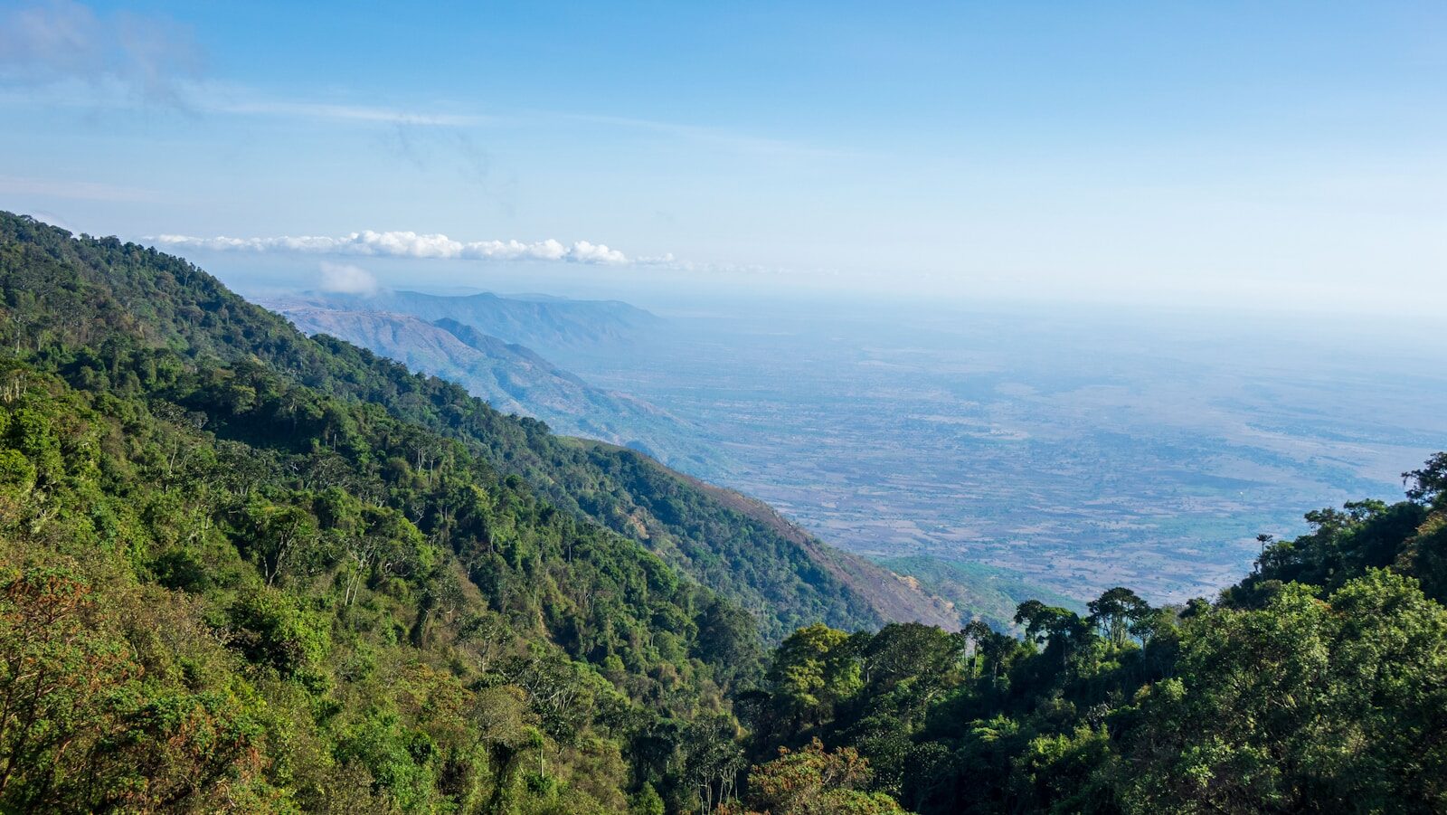
Beneath the plains of East Africa, one of the most dramatic geological events in Earth’s history is unfolding in slow motion. The African continent is being torn apart — and in approximately 5 to 10 million years, a new ocean will fill the void. This is not speculation or science fiction; it is the well-documented result of tectonic forces that have already created one of the most geologically active regions on Earth and that are currently reshaping the geography of East Africa in ways measurable by modern satellite technology. Understanding this process illuminates not just Earth’s deep past but the forces that will define its geological future — and offers insights into the continental rifting and ocean formation processes that have shaped every ocean on Earth.
The East African Rift System: Earth’s Largest Active Rift
The East African Rift System (EARS) stretches approximately 3,000 kilometers from the Afar Triangle in northeastern Ethiopia south through Kenya, Tanzania, Malawi, and Mozambique. It is the world’s largest active continental rift — a zone where tectonic forces are pulling the African plate apart, stretching and thinning the crust, and creating the geological conditions for continental separation.
The rift system has two primary branches:
- The Eastern Rift (Gregory Rift): Running through Ethiopia, Kenya, and Tanzania, this branch is more seismically and volcanically active. It contains the Afar Triangle — one of the only places on Earth where an active triple junction between three tectonic plates (the African, Somali, and Arabian plates) is exposed on land. The Eastern Rift contains the world-famous Kenyan Rift Valley lakes including Turkana, Baringo, Bogoria, Nakuru, Elementaita, Naivasha, and Magadi.
- The Western Rift (Albertine Rift): Running through Uganda, Democratic Republic of Congo, Rwanda, Burundi, Tanzania, and Malawi, the Western Rift contains some of the deepest lakes in the world — Lake Tanganyika (the world’s second deepest lake at 1,470 meters), Lake Malawi, Lake Albert, and Lake Edward. These lakes fill deep rift valleys created by the subsidence of the crust as it is pulled apart.
Plate Tectonics Driving the Rift: The Three-Plate System
What makes the East African Rift unique is that it is not simply a two-plate boundary — it is a triple junction, where three tectonic plates are diverging simultaneously. The three players are:
- The Nubian Plate: The main African plate, comprising most of the African continent west of the rift
- The Somali Plate: The plate comprising the Horn of Africa and the eastern portion of the continent, which is separating from the Nubian plate along the Eastern Rift
- The Arabian Plate: Already largely separated from Africa, the Arabian Plate’s divergence from the African/Nubian plate has already created the Red Sea and Gulf of Aden — the “young oceans” that represent a more advanced stage of the same rifting process now beginning in the East African interior
The Afar Triangle — the lowland region of Ethiopia and Djibouti where these three plates meet — is arguably the most scientifically significant geological region on Earth for understanding oceanic crust formation. At its lowest points, the Afar Triangle already lies below sea level. The region is experiencing extension rates of 1-2 centimeters per year in some areas — exceptionally fast by geological standards — driven by a deep mantle plume of hot material rising beneath East Africa (the “African Superplume”) that is both thermally weakening the crust and driving the plate divergence.
The 2005 Afar Crack: A Rift Event in Real Time
In September 2005, one of the most dramatic rifting events in recorded geological history occurred in the Afar region of Ethiopia. Over just ten days, a series of volcanic eruptions and earthquakes created a 60-kilometer long, 8-meter wide crack in the Earth’s surface — the Dabbahu (or Boina) crack — accompanied by a dike injection of magma (partially solidified into basalt) along the entire length of the rift segment. This single event extended the rift by approximately 8 meters over its 60-kilometer length.
Scientists monitoring the event with GPS networks, seismometers, and satellite radar (InSAR — Interferometric Synthetic Aperture Radar) were able to reconstruct the event’s mechanics in unprecedented detail. The data confirmed that the rifting was proceeding through the same episodic process that created the world’s mid-ocean ridges: not gradual, steady extension but sudden, large-magnitude events separated by longer periods of relative quiescence. This is exactly how the Atlantic Ocean was created — one rift event at a time, over tens of millions of years.
Since 2005, continued monitoring has documented additional rifting episodes in the Afar region, confirming that this is an ongoing, active process. Ethiopian and international volcanologists maintain extensive seismic monitoring networks throughout the Afar region precisely because the ongoing rifting creates substantial volcanic hazard for communities in one of Ethiopia’s most populated and agriculturally important regions.
The Red Sea and Gulf of Aden: The Future of East Africa’s New Ocean
To understand what East Africa’s new ocean will look like, geologists look at the Red Sea and Gulf of Aden — water bodies that represent a more mature stage of exactly the same rifting process. The Red Sea is approximately 30 million years old. The Arabian Peninsula was once attached to Africa; rifting began in the Oligocene epoch and has since created the world’s youngest ocean basin. At its northern end, the Red Sea is still shallow and continental in character; at its southern end and center, it has developed a mid-ocean ridge with oceanic crust — the same process that will eventually characterize East Africa’s new ocean basin.
The sequence of events that creates an ocean from a continental rift is well documented from the geological record and can be summarized in five stages:
- Stage 1 — Continental rifting: The continental crust is stretched and thinned, creating rift valleys and grabens (fault-bounded depressions). Lakes fill the subsiding valleys. East Africa is in this stage now.
- Stage 2 — Incipient ocean: The crust thins to the point where mantle material directly erupts as basalt, creating proto-oceanic crust. The rift fills with water as it drops below sea level. The Afar Triangle is at the very beginning of this stage.
- Stage 3 — Young ocean: A narrow, shallow ocean forms, with a central mid-ocean ridge producing new oceanic crust. The Red Sea is in this stage.
- Stage 4 — Maturing ocean: The ocean widens as plate spreading continues, becoming a mature ocean with a full mid-ocean ridge system. The Atlantic Ocean is a mature example of this stage.
- Stage 5 — Declining ocean: Subduction begins at the ocean margins, and the ocean eventually closes. The Pacific Ocean is entering this stage, as subduction around its margins consumes more crust than the mid-ocean ridge creates.
Timeline: When Will the New Ocean Form?
The question of timing is one of the most common asked about the East African Rift. The honest answer requires distinguishing between different stages of the process:
Visible rift features: Already exist and are expanding. The Afar Triangle, Rift Valley lakes, and the 2005 crack are all visible now. The average rate of rift extension in the EARS ranges from about 2 mm per year in the southern Malawi Rift to about 16-20 mm per year in the northern Afar region.
Coastal flooding of the rift: For sea water to enter the rift from the Gulf of Aden or the Red Sea and flood the Afar depression (which already lies partially below sea level), specific geological thresholds must be crossed. Estimates range from 1 to 5 million years for initial marine flooding of the rift.
A recognizable young ocean: For the EARS to develop into a structure comparable to today’s Red Sea would take approximately 5 to 10 million years. Geologically, this is relatively rapid; on a human timescale, it is incomprehensibly long.
A mature open ocean: For the new ocean to reach a size comparable to the Atlantic Ocean would require hundreds of millions of years — timescales that dwarf human civilization by a factor of many thousands.
Lakes, Biodiversity, and the Human Dimension
The East African Rift is not merely a geological curiosity — it has profound implications for biodiversity and human civilization. The rift valley lakes are biodiversity hotspots of global significance. Lake Tanganyika, for example, contains approximately 350 species of fish found nowhere else on Earth — a dramatic example of evolution in isolation driven by the geological containment of species populations in deep, ancient lake basins created by rifting. Lake Victoria, Lake Malawi, and the other rift lakes are similarly remarkable for their endemic biodiversity.
The East African Rift also holds profound significance for human evolution. The rift valley’s unique geological dynamics — creating varied topography, freshwater lakes, and diverse habitats in close proximity — are believed to have played a critical role in hominid evolution. The fossil record of human ancestors found in the Afar region, the Olduvai Gorge in Tanzania, and other rift valley sites represents the most complete record of early human evolution anywhere on Earth. Australopithecus afarensis — “Lucy,” the famous 3.2-million-year-old skeleton — was discovered in the Afar region, directly in the zone of most intense current rifting.
Current Research and Monitoring
The East African Rift is among the most intensively studied geological systems on Earth. International research programs including the Eastern Africa Lithospheric Structure (EALS) project, the USGS-funded EARS Seismological Network, and the European Research Council-funded RiftVolc program maintain networks of seismometers, GPS stations, tiltmeters, and satellite monitoring arrays across the rift system. These networks provide continuous data on seismic activity, ground deformation, volcanic gas emissions, and crustal movement.
The primary applied purposes of this monitoring are volcanic hazard assessment and earthquake preparedness for the millions of people living in and around the rift system. Major population centers including Nairobi (Kenya), Addis Ababa (Ethiopia), Kampala (Uganda), and Dar es Salaam (Tanzania) are located in or near the rift system and are subject to seismic and volcanic hazards associated with ongoing rifting activity.
The East African Rift is, in every meaningful sense, the birth of an ocean — a process that has shaped every body of water on Earth, playing out in real time over a geography inhabited by hundreds of millions of people. It is one of the most extraordinary intersections of geological time and human time on the planet, a reminder that the Earth’s surface we take as permanent is, on geological timescales, continuously in motion.
For more on Earth system science and environmental topics, explore our coverage of climate impacts on US landscapes, atmospheric pollution and its global reach, and the freshwater crises reshaping American geography.
Water Footprint Impact Calculator
Measure direct and virtual water consumption across household, agricultural, and industrial supply chains against regional watershed stress metrics.
Calculate Water Footprint →

