🎬 Watch our Web Story: America’s Vanishing Groundwater: The Invisible Crisis Beneath Our Feet
📖 Related: Lake Powell Water Crisis: 3 Devastating Hidden Costs | Can We Refill the Earth? Managed Aquifer Recharge
Fly over Kansas, Arizona, or California, and you will see a miracle: perfectly circular fields of lush green corn and alfalfa thriving in the middle of an arid desert.
But this miracle is an illusion.
Beneath the soil, a catastrophe is unfolding. These crops are not being watered by rain, but by ancient aquifers—underground oceans formed over thousands of years. Today, America is pumping this water to the surface faster than nature can replace it.
According to recent investigations, including a landmark analysis by the New York Times, the United States is systematically depleting its groundwater reserves, leading to a crisis that threatens the nation’s food supply, its economy, and the very ground we stand on.
The Scale of the Drain
Groundwater provides nearly 45% of the water used for irrigation in the US and supplies drinking water to nearly half the population.
However, we are treating this resource like an infinite bank account.
- The Deficit: In many parts of the High Plains and the Southwest, aquifers are being drained at 10 to 50 times the rate of natural recharge.
- The “Fossil” Water: Much of this water is “fossil water,” trapped underground during the last Ice Age. Once it is gone, it is gone forever.
Ground Zero: The Ogallala Aquifer
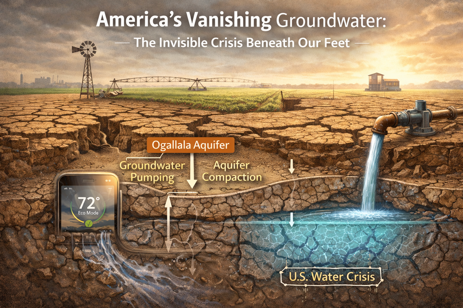
The massive Ogallala Aquifer stretches across eight states, from South Dakota to Texas. It is the engine of American agriculture, supporting the “Breadbasket of the World.”
But the engine is running out of fuel.
- In parts of the Texas Panhandle and Kansas, the water table has dropped by over 150 feet.
- Farmers who once pumped 1,000 gallons a minute are now struggling to pump 300.
- As the water drops, the cost of electricity to pump it from the depths skyrockets, pushing small family farms into bankruptcy.
The Physical Consequence: Sinking Land
When you suck the water out of a sponge, it shrinks. The Earth does the same. This phenomenon is called Land Subsidence.
In California’s San Joaquin Valley, the ground has sunk by as much as 28 feet in the last century. This isn’t just a geological curiosity; it destroys infrastructure.
- Cracked Canals: The very canals meant to deliver surface water are buckling as the ground sinks.
- Damaged Roads: Highways and bridges are warping.
- Aquifer Compaction: The most dangerous part is “compaction.” Once the clay layers in an aquifer collapse, they can never hold water again. We are permanently destroying the storage tank.
Why Is This Happening? The Regulatory “Wild West”
Unlike surface water (rivers/lakes), which is heavily regulated, groundwater in the US is often governed by the archaic “Rule of Capture.”
In many states, if you own the land, you can pump as much water as you want, regardless of how it affects your neighbor. This creates a “Race to the Bottom.” If you don’t pump the water, your neighbor will. This lack of federal oversight has allowed industrial agriculture to drain aquifers unchecked for decades.
The Link to Climate Change
Climate change acts as a “threat multiplier” for groundwater depletion.
- Hotter Droughts: As surface rivers (like the Colorado River) dry up due to aridification, farmers are forced to pump more groundwater to survive.
- Thirsty Air: Higher temperatures increase evaporation from soil and crops, increasing the water demand.
Is There a Solution?
The situation is dire, but not hopeless. Solutions exist, but they require political will.
1. Managed Aquifer Recharge (MAR)
Instead of letting storm water run into the ocean, we can divert floodwaters onto porous landscapes to soak back into the ground. (See our guide on Can We Refill the Earth?)
2. Crop Switching
We are currently growing thirsty crops like almonds, alfalfa, and cotton in the desert. Shifting to drought-resistant crops or high-value, low-water produce is essential.
3. Ending the “Open Loop”
States like Arizona and California are finally beginning to pass laws limiting groundwater extraction, though implementation is slow.
Conclusion: The End of the Free Lunch
The era of unlimited, cheap water in America is over. We have spent the last century living beyond our hydrological means. To save our future, we must make the invisible crisis visible and treat groundwater not as a commodity to be exploited, but as a strategic national reserve to be protected.
Further Reading:
The Ogallala Aquifer: America’s Water Battery Running Low
The High Plains Aquifer — better known as the Ogallala — stretches beneath 8 states and 174,000 square miles: Nebraska, Kansas, Oklahoma, Texas, South Dakota, Wyoming, Colorado, and New Mexico. It is the single most important groundwater resource in the United States, supplying 30% of all groundwater pumped for irrigation in the country and supporting a $35 billion annual agricultural economy.
The Ogallala formed over millions of years from ancient sediment washed down from the Rocky Mountains. It is essentially a non-renewable resource — it recharges at a rate of just half an inch per year in some areas, while farmers pump 1–3 feet per year in the driest regions. In the Texas Panhandle and western Kansas, water tables have dropped 100–300 feet since large-scale irrigation began in the 1940s.
At current rates of depletion, Kansas State University researchers project that the southern Ogallala — which underlies western Kansas and the Texas Panhandle — could be effectively exhausted for irrigation purposes within 25–50 years. That would mean the end of large-scale farming in a region that currently produces a significant share of American wheat, corn, sorghum, and cattle feed.
States in Crisis: Where Groundwater Depletion Is Most Severe
- California: The Central Valley has experienced some of the most dramatic aquifer depletion in the world. In parts of the Tulare Basin, land has subsided by up to 28 feet since the 1920s as underground water was pumped out. NASA satellites have detected active sinking of 2 inches per year in some areas. California’s SGMA law (2014) mandated sustainable groundwater plans, but full compliance deadlines stretch to 2040 in the most critically overdrafted basins.
- Texas: The Texas Panhandle overlies the shallowest and most stressed portion of the Ogallala. Several counties have already switched from irrigated to dryland farming as wells run dry. The Edwards Aquifer in central Texas, which supplies San Antonio, faces persistent conflicts between urban water demands and endangered species protections.
- Arizona: Decades of over-pumping in the Phoenix and Tucson metro areas caused significant land subsidence and infrastructure damage. Arizona was the first state to regulate groundwater (1980 Groundwater Management Act) and has invested heavily in the Colorado River water banking programs that now provide a critical buffer.
- Kansas and Nebraska: Western Kansas farmers have begun to see wells run dry. Nebraska has implemented groundwater management districts, but voluntary conservation has proved insufficient to halt long-term depletion trends.
- Georgia and Florida: The Floridan Aquifer, which supplies much of the Southeast’s water, faces saltwater intrusion along coastlines as pumping lowers water tables, allowing seawater to infiltrate. This affects drinking water quality for millions of residents.
The Food Supply Connection: What Groundwater Depletion Means for Your Table
The United States produces more than 20% of global food exports. Much of that production — especially in the arid West — depends directly on groundwater. The implications of aquifer depletion go far beyond regional water management:
- Wheat and corn prices: Kansas and Nebraska grow a large proportion of US winter wheat. If Ogallala-dependent farms transition to dryland farming, yields will fall by 50–80% in the driest regions, contributing to higher food prices nationally.
- Beef and dairy: The feedlots of the Texas Panhandle and western Kansas feed millions of cattle annually. These operations rely almost entirely on Ogallala water for feed grain and direct cattle consumption.
- Fruits and vegetables: California’s Central Valley produces more than half of US fruits, vegetables, and nuts. Fallowing of irrigated land due to groundwater restrictions under SGMA could reduce output significantly.
- Export competitiveness: As other grain-producing countries maintain water security, US agricultural exports face growing pressure as domestic production costs rise with water scarcity.
Solutions: Can We Reverse the Crisis?
The good news is that groundwater depletion is a solvable problem — but solving it requires political will, investment, and behavioral change at scale. Key strategies include:
- Managed Aquifer Recharge (MAR): Intentionally recharging aquifers with surplus surface water during wet years. Arizona’s Water Banking Authority has stored over 10 million acre-feet underground. California is rapidly expanding spreading basin infrastructure. Read more about MAR here.
- Precision irrigation: Drip irrigation, soil moisture sensors, and AI-driven irrigation scheduling can reduce water application by 30–50% with no yield penalty. Federal cost-share programs under the 2026 Farm Bill are expanding access to these technologies.
- Crop switching: Transitioning from water-intensive crops (alfalfa, corn) to less water-intensive alternatives (sorghum, native grasses, drought-tolerant varieties) reduces demand without abandoning farming.
- Water markets and pricing reform: Many western groundwater users pay nothing for the water they extract. Introducing fair pricing mechanisms would incentivize conservation without harming farming viability if structured carefully.
- Stronger state and federal policy: California’s SGMA is a model others are following. But many states still have weak or no groundwater regulation. Federal action to standardize minimum sustainability standards could accelerate reform.
The crisis is urgent — but America has fixed major resource crises before. The restoration of the Great Plains after the Dust Bowl, the cleanup of the Great Lakes, and the recovery of the ozone layer all demonstrate what’s possible when science, policy, and public will align. The vanishing groundwater beneath our feet deserves the same commitment.
Authoritative Source: Bureau of Reclamation – Water Data
Water Footprint Impact Calculator
Measure direct and virtual water consumption across household, agricultural, and industrial supply chains against regional watershed stress metrics.
Calculate Water Footprint →