Decoding the ECMWF Forecast: A Record-Strength El Niño 2026?
The European Centre for Medium-Range Weather Forecasts (ECMWF) is globally recognized for its highly accurate, medium-range atmospheric modeling. Their April 1 ensemble runs delivered a striking warning to the meteorological community. The models project that sea surface temperatures in the critical Niño 3.4 region could surge to +2.5°C above the historical average by October 2026.
Even more alarming, multiple model iterations push this anomaly past the +3°C threshold. If these projections verify, this event would match or potentially surpass the devastating 1997-1998 “Super El Niño.” This sudden departure from the current weak La Niña represents a massive release of oceanic heat into the atmosphere.
To comprehend the magnitude of a Record-Strength El Niño 2026, we must look beyond isolated weather events and examine the systemic mechanisms driving them. The weakening of the easterly trade winds allows warm surface water, typically pooled in the western Pacific, to slosh eastward toward South America.
Table of Contents
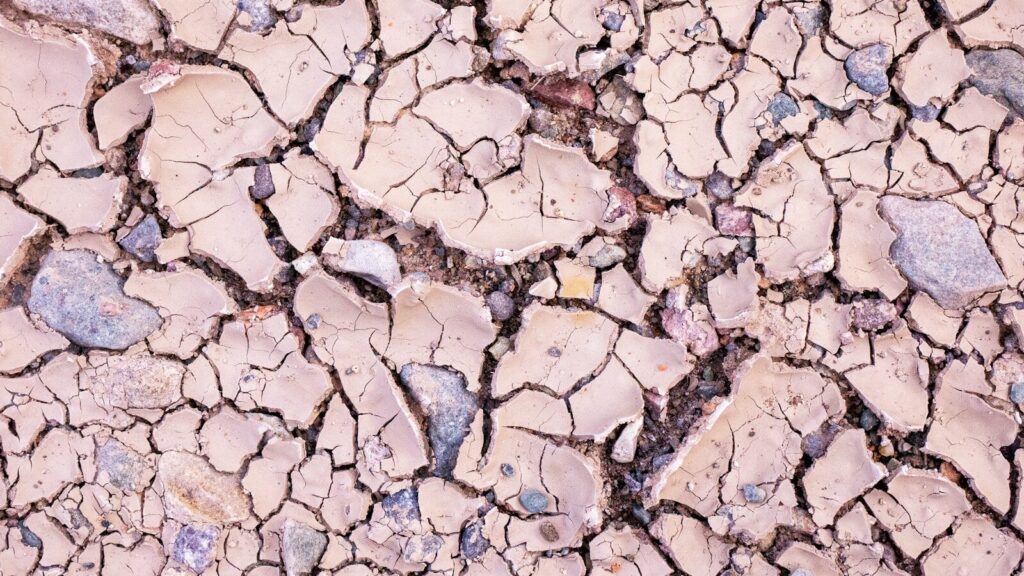
Deep cracks in parched soil demonstrate the severe agricultural realities of global weather extremes. A Record-Strength El Niño 2026 will severely test agricultural resilience in regions prone to sudden precipitation deficits.
Prolonged moisture deficits drastically reduce crop yields and stress local economies.
Global Climate Impacts and Ecological Economics
When the Pacific Ocean warms to these extreme levels, it permanently alters the global atmospheric circulation, known as the Walker Circulation. This thermodynamic shift acts as a domino effect, triggering complex feedback loops across different continents.
The economic fallout from these interconnected climatic events is immense. We must view these disruptions not just as weather phenomena, but as foundational shocks to global ecological economics. For related insights into how shifting oceans alter trade, see our comprehensive analysis on marine ecosystems.
Pacific Flooding and Indonesian Droughts
The immediate epicenter of El Niño’s wrath is the Pacific basin. As warm water migrates eastward, massive convective thunderstorms follow it. This shift pulls vital rainfall away from the western Pacific and dumps it onto the central and eastern regions.
Indonesia and Australia: These nations will likely face crippling droughts, heightening the risk of catastrophic wildfires and threatening global palm oil and wheat supplies.
Central Pacific and South America: Conversely, coastal regions of Peru and Ecuador brace for torrential floods, threatening infrastructure and the highly lucrative anchoveta fisheries.
These opposing extremes perfectly illustrate the zero-sum nature of global moisture distribution during major El Niño events.
Agricultural Shifts and Northern Hemisphere Extremes
Further north, the atmospheric wave patterns dictated by the Pacific warming will heavily influence the United States and Europe. The Record-Strength El Niño 2026 is forecasted to inject a powerful subtropical jet stream across the southern and central United States.
This typically results in much wetter summer conditions for the U.S. Midwest. While some moisture is beneficial, excessive rainfall can delay planting seasons and rot root systems, challenging agricultural output. Meanwhile, the Atlantic hurricane season is expected to be remarkably quiet, as El Niño generates hostile upper-level wind shear that tears apart developing tropical cyclones.
Europe faces a vastly different threat profile. The altered jet stream patterns frequently trap high-pressure “blocking domes” over the continent. This setup suggests that hotter, more prolonged European heatwaves are highly probable, stressing energy grids and increasing heat-related mortality rates.
Data Summary: Projected Regional Impacts
To better visualize these shifting dynamics, the following table compares typical weak La Niña conditions against the severe disruptions expected from the upcoming atmospheric shift.
Global Region
Current State (Weak La Niña)
Projected Impact (El Niño 2026)
Economic Sector at High Risk
Indonesia / Australia
Above-average rainfall
Severe drought and high wildfire risk
Agriculture, Mining, Forestry
U.S. Midwest
Variable to dry summers
Unseasonably wet, high flood risk
Corn & Soybean Commodities
Tropical Atlantic
Highly active hurricane season
Suppressed storm development
Coastal Real Estate, Insurance
Western Europe
Moderate summer temperatures
Extreme, prolonged heatwaves
Energy Grids, Public Health
South America (West)
Cool waters, dry coasts
Torrential rains, fisheries collapse
Commercial Fishing, Infrastructure
Why the Record-Strength El Niño 2026 Matters Systemically
While climate models from the National Oceanic and Atmospheric Administration also indicate warming, the ECMWF’s aggressive +3°C runs highlight a crucial vulnerability in our global systems. We are transitioning from a prolonged period of oceanic cooling directly into a massive heating phase.
This whipsaw effect leaves ecosystems and economies dangerously little time to adapt. In the context of broader ecological economics, an extreme El Niño acts as a threat multiplier. It exacerbates existing supply chain bottlenecks, drives up global food inflation, and stresses water resources in regions already grappling with baseline climate shifts.
For a deeper dive into how policy must adapt to these rapid changes, review our latest systemic overview on climate legislation.
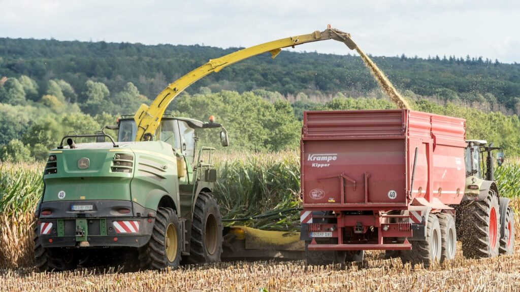
A tractor working through a dense crop field highlights the need for advanced agricultural resilience. Farmers must monitor ECMWF climate models closely to prepare for the heavy rains expected from a Record-Strength El Niño 2026.
Predictive climate data is becoming the most vital input for modern agricultural success.
Preparing for the Record-Strength El Niño 2026
Uncertainty remains a factor in all meteorological forecasting. However, the sheer consensus among leading atmospheric models requires immediate proactive measures. Waiting for the ocean temperatures to peak before acting guarantees economic losses.
Commodity Markets: Traders and buyers must secure futures and diversify supply lines for crops vulnerable to both droughts (coffee, palm oil) and floods (midwestern grains).
Infrastructure Management: European municipalities must audit their electrical grids to withstand the cooling demands of extreme heatwaves.
Water Conservation: Regions facing drought must implement aggressive water retention strategies long before the seasonal rains fail.
Understanding the “Why” behind the Record-Strength El Niño 2026 empowers leaders to move from reactive disaster management to proactive resilience planning. The heat trapped in the Pacific is a physical reality; how our global systems absorb that shock depends entirely on our preparation today.
Oceanic Current Disruptions: Causes, Impacts & What Comes Next
Oceanic currents keep Earth’s climate stable. They move heat, nutrients, and carbon across the planet with clockwork-like reliability. But new science shows these systems — especially the Atlantic Meridional Overturning Circulation (AMOC) — are slowing faster than previously expected.
The result: more extreme weather, disrupted fisheries, shifting rainfall patterns, and destabilized coastlines.
This article breaks down why ocean current disruptions matter now, what’s driving them, and what a future with weaker currents could look like.
Table of Contents
1. What’s Happening to Earth’s Major Ocean Currents?
The world’s major surface and deep-water currents form the global conveyor belt, a system that moves warm, salty water north and cold deep water south.
Today, scientists are observing:
Slowing AMOC circulation
Weaker Gulf Stream flow
Increasing freshwater input from melting ice
Record marine heatwaves disrupting regional current patterns
Shifted upwelling zones along the Pacific and Atlantic coasts
These trends point to a gradual destabilization rather than a sudden collapse — but the implications are far-reaching.
2. What’s Driving Oceanic Current Disruptions?
a. Melting Ice and Freshwater Injection
Melting from Greenland dilutes North Atlantic seawater. Less salinity = less dense water = weaker sinking motion. This directly slows AMOC.
b. Rising Ocean Temperatures
Warm water expands and stratifies, creating stable layers that block vertical mixing.
c. Changing Wind Patterns
Stronger subtropical winds and altered jet streams shift where currents form and how they move.
d. Declines in Winter Sea Ice
Open water in winter affects heat exchange and deep-water formation zones.
3. Climate Consequences: Why This Matters
Ocean currents act as Earth’s climate stabilizers. When they weaken, the effects ripple across continents.
Shipping: intensified storms disrupt global trade routes
Insurance costs: coastal risk premiums are rising across the U.S.
The world’s food-energy-water systems are connected — and ocean current instability stresses all three.
5. Are We Approaching a Tipping Point?
Some models warn AMOC could weaken 40–60% by the end of the century. A full collapse remains unlikely in the near term — but partial disruptions are already causing systemic changes.
Key signs of potential tipping behavior:
accelerating Greenland melt
persistent marine heatwaves
long-term salinity declines
weakening subpolar gyre circulation
These are the “early warning signals” scientists watch closely.
6. What a Future With Weaker Currents Might Look Like
By mid-century, the world may see:
North America
More volatile winters
Stronger summer heat and humidity
Higher East Coast sea-level rise
Changing storm tracks
Europe
Colder winters in parts of Western Europe
More rainfall in the Mediterranean
Agricultural zone shifts
Tropics
Worsening coral bleaching
Deeper food security risks
Stronger monsoons
Ocean currents are the spine of the climate system — altering them affects everything built on top of it.
7. Solutions & Adaptation Pathways
a. Rapid Emissions Reductions
Slowing warming is the single largest factor in reducing AMOC risk.
b. Protecting and Restoring Blue Carbon Systems
Mangroves, seagrasses, and coastal wetlands help stabilize coastlines and store carbon.
c. Strengthening Climate-Resilient Infrastructure
Especially across the U.S. East Coast, where hotspots of sea-level rise are emerging.
d. Monitoring and Predictive Modeling
Investments in ocean sensors, satellites, and climate models help detect early shifts.
Frequently Asked Questions
Why are ocean currents slowing down?
Mainly due to melting ice, changes in salinity, and warming oceans — all linked to climate change.
Could the Gulf Stream collapse?
Full collapse is unlikely this century, but substantial weakening is already happening and will influence U.S. weather and sea levels.
How do ocean currents affect food systems?
They control nutrient distribution, fish migrations, and marine productivity.
What regions are most at risk?
The U.S. East Coast, North Atlantic, Europe, and equatorial ecosystems.
Unprecedented Louisiana Wildfires: Evacuations and Burn Bans Amid Extreme Drought
The summer of 2023 brought an unexpected and severe ecological crisis to the American South. The unprecedented Louisiana wildfires forced widespread evacuations and triggered strict statewide burn bans. Historically, this coastal region prepares for hurricanes and floods rather than raging infernos.
Therefore, this drastic shift in weather patterns requires immediate scientific analysis. The event highlights severe climate change impacts that are altering regional vulnerability. Consequently, understanding this crisis is essential for protecting vulnerable communities and fragile ecosystems.
This article explores the fundamental mechanisms driving these fires. Furthermore, it outlines the ecological consequences and proposes strategic solutions for better forest fire management. Ultimately, readers will gain actionable insights into navigating this new environmental reality.
Table of Contents
Key Concepts and Scientific Foundation of the Louisiana Wildfires
Understanding this unprecedented crisis requires a clear grasp of meteorological and ecological mechanisms. The scientific community closely monitored the drastic weather anomalies leading up to the disaster. Together, these factors created the perfect storm for combustion.
Definitions of Extreme Weather
Extreme drought conditions occur when a region experiences a prolonged and severe deficit in precipitation. This deficit drastically reduces soil moisture and dries out vegetation. Consequently, the local landscape transforms into highly combustible fuel.
Fire weather refers to specific atmospheric conditions that promote rapid fire spread. These conditions include high temperatures, low relative humidity, and strong, gusty winds. Therefore, when extreme drought meets fire weather, the risk of uncontrollable blazes skyrockets.
Mechanisms of Ignition and Spread
Fires require heat, oxygen, and fuel to sustain themselves. During the Louisiana wildfires, record-breaking triple-digit temperatures provided the necessary ambient heat. Additionally, the severe lack of rainfall eliminated the natural moisture barrier that usually protects southern pine forests.
Once ignited, these fires spread aggressively through the tree canopy. High winds carried embers miles ahead of the main fire line. Subsequently, these flying embers ignited new spot fires, which made containment incredibly difficult for first responders.
Causes Rooted in Climate Alterations
A persistent high-pressure system, often called a heat dome, trapped hot air over the region for weeks. This phenomenon prevented moisture from the Gulf of Mexico from forming rain clouds. As a result, the state experienced its hottest and driest summer on record.
Furthermore, past natural disasters contributed to the fuel load. Millions of trees blown down by previous hurricanes lay dead and drying on the forest floor. Consequently, this excess timber acted as massive kindling for the advancing flames.
Systems Involved in the Crisis
Forest fire management systems were pushed entirely beyond their operational limits. Local and state agencies lacked the specialized equipment required for massive, fast-moving canopy fires. Therefore, the state had to request emergency assistance from federal agencies and neighboring states.
Environmental and Economic Impacts
The sheer scale of the blazes generated catastrophic real-world outcomes. These impacts severely damaged both local ecosystems and regional economies. Indeed, the recovery process will take decades to complete.
Data on the Devastation
During the peak of the crisis, more than 60,000 acres burned across the state. The Tiger Island Fire alone consumed over 33,000 acres of land. Consequently, this single event accounted for more burned area than the state typically sees in an entire year.
Temperature records shattered across multiple parishes. Cities experienced consecutive days of temperatures exceeding 100 degrees Fahrenheit. Therefore, the statistical anomalies of this event are staggering to climatologists.
Ecological Consequences
The ecological damage from the Louisiana wildfires is profound and long-lasting. Critical habitats for native wildlife were completely incinerated within days. Furthermore, the intense heat sterilized the topsoil, which severely delays the natural regeneration of plant life.
Additionally, the blazes released massive amounts of stored carbon dioxide into the atmosphere. This release creates a dangerous feedback loop that accelerates global warming. Ultimately, the loss of these mature forests removes a vital carbon sink from the regional ecosystem.
Financial Implications
The financial toll on the timber industry is astronomical. Thousands of acres of commercial pine plantations were destroyed. As a result, local economies that rely heavily on logging and paper production face severe long-term economic depression.
Furthermore, the cost of emergency response efforts drained state budgets. Deploying aircraft, heavy machinery, and thousands of personnel required millions of dollars. Therefore, taxpayers will ultimately bear the financial burden of these suppression efforts.
Global and Regional Impacts
The regional impacts extended far beyond the burn scars. Thick plumes of smoke drifted hundreds of miles, which triggered severe air quality alerts across neighboring states. Consequently, vulnerable populations experienced a sharp increase in respiratory illnesses.
Real World Case Studies and Applications
Examining specific events provides a clear picture of the crisis on the ground. The response to these blazes forced local governments to adapt rapidly. Therefore, these case studies offer valuable lessons for future disaster preparedness.
Practical Examples of Displacement
The evacuation of Merryville stands as a stark practical example of the crisis. Over 1,000 residents were ordered to flee as the Tiger Island Fire rapidly approached the town limits. Consequently, emergency planners had to execute rapid evacuation protocols under extreme pressure.
Buses were deployed to transport residents who lacked personal vehicles. Furthermore, local nursing homes were evacuated to protect elderly citizens from the encroaching smoke and flames. Ultimately, this coordinated effort prevented mass casualties.
Policy Examples and Restrictions
In response to the escalating danger, the state government implemented absolute burn bans. The Louisiana Department of Agriculture and Forestry prohibited all agricultural burning. Similarly, the State Fire Marshal banned all private outdoor burning, including campfires and barbecue grills.
These strict policies aimed to eliminate human-caused ignitions. State officials actively issued citations to individuals who violated these emergency orders. Therefore, policy enforcement became a critical tool in preventing new outbreaks.
Technology and Innovation in Firefighting
First responders utilized advanced technology to combat the massive blazes. Helicopters and modified airplanes dropped millions of gallons of water directly onto the fire lines. Additionally, satellite imagery and Geographic Information Systems (GIS) helped commanders track the fire’s progression in real-time.
These technological tools allowed for precise resource allocation. Firefighters used bulldozers to cut extensive containment lines through the thick brush. Consequently, this heavy machinery proved essential in halting the fire’s forward momentum.
Geographic Examples of Vulnerability
Beauregard Parish became the epicenter of the unprecedented destruction. This heavily forested geographic area was particularly vulnerable due to its dense timber plantations. Furthermore, the rural nature of the parish meant that water resources for firefighting were incredibly scarce.
Challenges and Barriers in Forest Fire Management
Managing the Louisiana wildfires revealed significant systemic vulnerabilities. The state was simply not equipped for a disaster of this specific nature. Addressing these barriers is critical for future resilience.
Political Obstacles
Securing immediate federal funding often faces bureaucratic delays. While the state quickly declared an emergency, navigating the Federal Emergency Management Agency (FEMA) requirements takes time. Consequently, local municipalities had to front the initial costs of the disaster response.
Economic Barriers
Rural fire departments operate on severely limited budgets. They rely heavily on volunteer firefighters and aging equipment. Therefore, these small departments were quickly overwhelmed by the massive scale of the blazes.
Upgrading equipment to handle massive canopy fires requires immense capital investment. Most local governments cannot afford specialized aircraft or large fleets of wildland fire engines. Ultimately, economic constraints limit the physical capacity to fight these fires.
Technical Challenges
Water scarcity presented a massive technical challenge during the extreme drought conditions. Many local ponds and creeks had completely dried up. As a result, firefighters had to truck water in from distant locations, which drastically slowed down suppression efforts.
Furthermore, shifting wind patterns constantly altered the fire’s direction. This unpredictability made it dangerous for crews to attack the flames directly. Consequently, firefighters had to rely on defensive strategies rather than offensive containment.
Social Resistance
Despite the extreme danger, some residents resisted the strict burn bans. A lack of public awareness regarding the severity of the drought led to accidental ignitions. Therefore, overcoming public complacency is a major hurdle in preventing future disasters.
Solutions and Strategic Pathways
Adapting to this new climate reality requires proactive and evidence-based strategies. The state must transition from reactive emergency response to proactive hazard mitigation. Fortunately, several strategic pathways offer clear solutions.
Evidence-Based Solutions
Implementing prescribed burns during safer weather windows is a highly effective scientific solution. These controlled fires clear out the dead vegetation that fuels massive blazes. Furthermore, routine prescribed burning mimics natural ecological cycles and promotes a healthier, more resilient forest.
Additionally, state agencies must invest in advanced soil moisture tracking systems. Monitoring drought stress in vegetation allows officials to predict fire danger months in advance. Consequently, early warning systems can trigger preventive measures before a crisis erupts.
Policy Reform Ideas
Legislators must establish permanent funding streams for forest fire management. This funding should explicitly support the purchase of wildland firefighting equipment and specialized training for local crews. Moreover, building codes in vulnerable rural areas should be updated to mandate fire-resistant roofing and siding.
Statewide burn bans must be tied directly to scientific drought indexes. When ecological indicators reach critical thresholds, bans should automatically activate. Therefore, this removes political hesitation from emergency declarations.
Individual Action Steps
Create a defensible space around your rural home by clearing dead brush and overhanging branches.
Strictly obey all local and state burn bans without exception.
Prepare a “go-bag” and establish clear evacuation protocols for your family.
Support local volunteer fire departments through donations and community advocacy.
Industry Level Transformation
The timber industry must adapt its planting and harvesting practices. Creating wide firebreaks between large plantations can prevent a single fire from destroying tens of thousands of acres. Ultimately, diversifying the types of trees planted can also reduce overall forest flammability.
Frequently Asked Questions
What caused the unprecedented Louisiana wildfires?
The fires were primarily driven by a combination of record-breaking heat and extreme drought conditions. Additionally, high winds and an abundance of dead timber from past hurricanes provided the perfect fuel for the rapidly spreading blazes.
Why were the burn bans so strictly enforced?
Because the vegetation was completely devoid of moisture, any small spark could ignite a massive inferno. State officials enforced strict burn bans to eliminate all human-caused fires and preserve exhausted firefighting resources for existing blazes.
How did the extreme drought conditions affect firefighting efforts?
The drought dried up local water sources like ponds and creeks. Firefighters lacked the necessary water to extinguish the flames quickly, which forced them to transport water over long distances and rely heavily on aerial drops.
Will the Louisiana wildfires happen again?
Climate scientists warn that rising global temperatures will make extreme weather events more frequent. While the state is historically known for floods, residents must now prepare for prolonged dry spells and the increased risk of severe fire seasons.
Conclusion
The historic Louisiana wildfires served as a devastating wake-up call for the American South. The combination of extreme drought conditions, record heat, and abundant fuel created an unstoppable force of nature. Consequently, this crisis forced a rapid reevaluation of how the region handles environmental emergencies.
Effective forest fire management now requires proactive planning and substantial investment. By learning from these mass evacuations and enforcing strict burn bans, communities can better protect themselves. Furthermore, recognizing the undeniable climate change impacts driving these events is essential for long-term survival.
As weather patterns continue to shift, staying informed and prepared is your best defense. Review your local evacuation protocols today and support policies that prioritize proactive ecological management.
The Early Season Heatwave California Faces: Climate Risks and Solutions
An unprecedented weather event is rapidly unfolding across the western United States. Forecasters warn that a brutal system will push temperatures 20 to 30 degrees Fahrenheit above normal for several consecutive days. The early season heatwave California and neighboring states are experiencing threatens to shatter all time historical temperature records for March.
This extreme weather anomaly matters because it creates immediate public health emergencies and drastically accelerates snowpack melting. Western states rely heavily on a gradual spring snowmelt to sustain water supplies. When extreme heat arrives months ahead of schedule, it jeopardizes water security and amplifies drought conditions significantly.
The National Weather Service notes that over 26 million people will face elevated heat risks. Furthermore, tens of thousands will endure extreme heat with zero overnight relief. We will analyze the meteorological mechanisms driving this intense heat, evaluate the resulting ecological consequences, and outline necessary strategic solutions.
Table of Contents
The Science Behind the Early Season Heatwave California Faces
Meteorologists attribute this extreme temperature spike to a large and persistent dome of atmospheric pressure. A massive high pressure ridge is settling over a vast swath of the western United States. This system acts like a lid in the atmosphere. Consequently, it traps hot air near the ground and prevents cooling marine layers from moving inland.
High pressure systems cause the air to sink toward the surface. As the air sinks, it compresses and warms rapidly. Furthermore, this atmospheric block forces incoming cold storms to detour far around the region. Scientists consider this specific ridge to be among the strongest ever observed in the southwestern United States during March.
These pressure systems typically develop during the peak summer months. Therefore, witnessing a heat dome of this magnitude and persistence in early spring is highly anomalous. The primary blasts of heat are arriving in two distinct waves. The first wave hits the west coast immediately, while a stronger secondary wave will reorganize and expand eastward into Utah, Colorado, and Wyoming next week.
This highly unusual timing makes the early season heatwave California faces particularly dangerous. The human body requires time to acclimate to seasonal temperature changes. Because people have not yet adapted to summer conditions, the physiological stress caused by these high temperatures is magnified.
Environmental and Economic Impacts
The most severe ecological consequence of this weather event involves the dramatic acceleration of mountain snowmelt. Regional water managers nervously monitor the declining snowpacks across the western mountains. Historically, these areas experienced their warmest winter on record, resulting in deeply depleted initial snow levels.
Prolonged heat actively bakes essential moisture straight out of the high altitude landscapes. Experts now project that the critical spring snowpack measurement on April 1 will likely be the worst on record across most western watersheds. This rapid depletion prevents reservoirs from efficiently capturing and storing water for the dry summer and fall seasons.
Consequently, this rapid melting translates into devastating financial implications. The agricultural sector relies heavily on consistent and predictable water allocations from these melting snowpacks. When reservoirs fail to fill adequately, authorities force farmers to execute extreme cutbacks. These cutbacks lead to reduced crop yields and massive economic losses for rural communities.
Additionally, this early season heatwave California must navigate significantly amplifies regional wildfire risks. Extreme temperatures dry out vegetation rapidly. This creates abundant dry fuel sources that allow early spring ignitions to transform into massive infernos. Consequently, local and state governments must allocate substantial financial resources to fund extended fire suppression efforts.
Geographic Impacts
The data forecasting this early season heatwave California is enduring provides alarming geographical examples of extreme climate shifts. Los Angeles is projected to endure blistering temperatures exceeding 100 degrees Fahrenheit. The San Francisco Bay Area anticipates unusual highs reaching up to 90 degrees Fahrenheit.
Furthermore, the southeastern desert regions will likely see temperatures soar to a dangerous 110 degrees Fahrenheit. These figures thrust the entire region into peak summer conditions months before they typically arrive. Climate scientists warn that some locations might break daily high temperature records for seven to ten consecutive days.
This specific event demonstrates how extreme weather ignores municipal borders. The heat will initially scorch California, Nevada, Arizona, and New Mexico. Subsequently, the reorganized pressure system will push extreme temperatures deep into Oregon, Idaho, and the Rocky Mountain states.
These sprawling geographic impacts place an enormous burden on regional infrastructure. Power grids designed to handle peak loads in August must now operate at maximum capacity in March. Moreover, the lack of cool overnight temperatures prevents physical infrastructure like asphalt and concrete from releasing stored heat.
Challenges and Barriers
Adapting to an early season heatwave California style presents several significant obstacles for policymakers and residents. The primary technical challenge involves maintaining power grid resilience. Utility companies typically schedule essential power plant maintenance during the traditionally mild spring months.
Unexpected surges in air conditioning demand can easily overwhelm these compromised grids. This mismatch between infrastructure readiness and sudden energy demand creates a high risk for localized power failures. Furthermore, economic barriers severely complicate the public health response to extreme heat events.
Many municipalities lack the dedicated funding required to operate community cooling centers year round. Consequently, local governments scramble to open emergency facilities ahead of schedule. Socially, a general lack of preparedness exacerbates the danger. Citizens simply do not expect extreme heat threats during the month of March.
Therefore, vulnerable populations face the highest risks. The elderly, outdoor workers, and individuals without access to reliable hydration or air conditioning are incredibly susceptible to moderate heat risks. Public health agencies must overcome the barrier of communicating severe summer dangers during the spring season.
Solutions and Strategic Pathways
Mitigating the risks of an early season heatwave California faces requires immediate and evidence based policy reform. First, utility regulators must mandate flexible infrastructure maintenance schedules. Grid operators need the agility to suspend maintenance operations immediately when unseasonal heat waves appear in weather forecasts.
Second, urban planners must prioritize year round cooling infrastructure. City governments should accelerate the planting of drought resistant shade trees in vulnerable neighborhoods. Additionally, updating building codes to require reflective roofing materials will passively lower indoor temperatures and reduce grid strain.
On an agricultural level, the industry must fundamentally transform its water management strategies. Farmers must urgently accelerate the adoption of high efficiency drip irrigation technologies. Furthermore, state policies must incentivize the recycling of agricultural runoff to preserve the rapidly shrinking snowpack reserves.
Individually, citizens must take proactive steps to ensure personal safety. Residents need to prioritize hydration and establish communication plans to check on vulnerable neighbors. Communities must build localized resilience networks to distribute water and cooling resources rapidly during unseasonal heat spikes.
Frequently Asked Questions
Why is the early season heatwave California is experiencing so dangerous? Spring extreme heat is particularly dangerous because human bodies have not yet acclimated to high temperatures. This lack of physical adaptation significantly increases the risk of heat exhaustion and heatstroke among the general population.
How does a spring heat dome affect water supplies? High temperatures cause mountain snowpacks to melt prematurely and rapidly. This rapid runoff prevents downstream reservoirs from capturing water efficiently, which severely limits the water available for the long, dry summer months.
What populations are most vulnerable to March extreme heat? Outdoor workers, the elderly, and unhoused populations face the most severe risks. Additionally, individuals living in homes without air conditioning or those who lack access to emergency cooling centers are highly vulnerable to prolonged heat exposure.
Conclusion
The western United States is confronting a massive and historically significant climate anomaly. The severe early season heatwave California and surrounding states currently face demands immediate and decisive action. Exceptional March temperatures are actively destroying critical water supplies, amplifying regional wildfire risks, and endangering public health on a massive scale.
We must implement robust adaptation strategies and proactive water management policies immediately. Utility grids require modernization, and urban centers need permanent cooling infrastructure. Review your local emergency heat protocols today and prioritize the safety of vulnerable community members.
Hawaiian Bird Extinction Risk as Wildfires and Climate Change Intensify
Hawaiian bird extinction is accelerating as wildfires and climate change push native forest species to the brink. The Hawaiian Islands once supported more than 50 species of honeycreepers, yet today only a fraction remain. Habitat loss, invasive species, rising temperatures, and fire are converging into a systemic crisis.
This matters not only for biodiversity but also for ecosystem stability, cultural heritage, and climate resilience. In this article, we examine the science behind Hawaiian bird extinction, explore real world case studies, assess economic and ecological impacts, and outline strategic solutions that can still prevent irreversible loss.
Hawaiian birds evolved in geographic isolation over millions of years. As a result, they developed highly specialized ecological roles. However, this specialization now makes them extremely vulnerable.
Island Evolution and Vulnerability
Most native forest birds belong to the honeycreeper radiation, a classic example of adaptive evolution. Because Hawaii lacked land predators and mosquito borne diseases for most of its history, native birds evolved without defenses against these threats.
Consequently, even small environmental changes can trigger population collapse.
Climate Change and Mosquito Expansion
Rising temperatures are expanding the range of invasive mosquitoes into higher elevation forests. These mosquitoes transmit avian malaria and avian pox.
Historically, high elevation forests served as disease refuges. However, warming trends now allow mosquitoes to survive year round at elevations that once protected rare species.
Scientific monitoring shows that just a 1 to 2 degree Celsius increase in average temperature significantly increases mosquito survivability in montane habitats.
Wildfires in Native Forests
Wildfires were historically rare in Hawaiian ecosystems. Native forests evolved in moist conditions with low fire frequency.
However, invasive grasses such as fountain grass have created continuous fuel beds. Combined with prolonged drought linked to climate change, these grasses dramatically increase wildfire intensity and spread.
After fires, invasive plants often outcompete native vegetation, permanently degrading habitat critical to endangered birds.
Environmental and Economic Impacts of Hawaiian Bird Extinction
The consequences of Hawaiian bird extinction extend beyond biodiversity loss.
Ecological Disruption
Native birds play key roles in:
Pollination of endemic plants
Seed dispersal in montane forests
Insect population control
Without these birds, forest regeneration declines. Over time, this weakens watershed protection and increases erosion.
Healthy Hawaiian forests are vital for freshwater recharge. Their degradation affects water security for agriculture and communities.
Economic Implications
Hawaii’s economy relies heavily on tourism and ecosystem services. Birdwatching and ecotourism generate millions annually.
Furthermore, degraded forests increase wildfire suppression costs and watershed management expenses. Restoring burned areas requires substantial public investment.
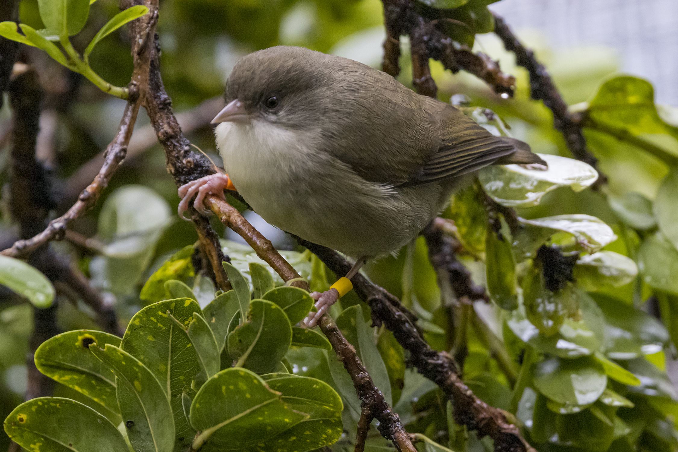
The ʻAkikiki, also known as the Kauai creeper, is one of the most critically endangered forest birds. Populations have plummeted due to avian malaria and habitat degradation.
Recent surveys indicate that only a small number remain in the wild. Conservation programs now rely on captive breeding to prevent total Hawaiian bird extinction of this species.
Image Description: ʻAkikiki perched on native forest branch in Kauai Suggested Source: Wikimedia Commons Alt Text: Critically endangered ʻAkikiki impacted by Hawaiian bird extinction crisis
Maui Wildfires and Forest Loss
The 2023 Maui wildfires demonstrated how quickly habitat can be lost. While coastal impacts dominated headlines, upland forests also experienced stress from drought and invasive grass spread.
Fire damaged critical bird habitat and increased future ignition risk. This feedback loop accelerates Hawaiian bird extinction by shrinking safe breeding zones.
Mosquito Control Innovation
Hawaii has initiated landscape scale mosquito suppression using incompatible insect techniques. By releasing sterile male mosquitoes, scientists aim to reduce disease transmission.
Early pilot programs show promise. If scaled effectively, this intervention could slow Hawaiian bird extinction across high elevation forests.
Hawaii’s remote location increases logistical costs for equipment, conservation staff, and restoration materials.
Funding Constraints
Long term ecosystem restoration requires sustained investment. However, funding cycles are often short term and reactive.
Invasive Species Management
Removing invasive plants and animals is technically complex. Even after removal, reinvasion risk remains high.
Climate Uncertainty
Projected warming trends indicate continued expansion of mosquito habitat. Without rapid emissions reductions globally, local conservation measures face uphill challenges.
Solutions and Strategic Pathways to Prevent Hawaiian Bird Extinction
Preventing Hawaiian bird extinction requires coordinated action across science, policy, and community engagement.
1. Landscape Scale Mosquito Suppression
Expand sterile male mosquito programs
Integrate biological control with habitat restoration
Monitor disease prevalence continuously
This strategy directly addresses avian malaria, currently the most acute driver of Hawaiian bird extinction.
2. Invasive Grass Removal and Fire Management
Mechanical removal of invasive grasses
Prescribed burns in controlled areas
Native species replanting to reduce fuel loads
Reducing wildfire frequency protects critical bird refuges.
3. High Elevation Forest Protection
Designate additional conservation areas
Restrict development near sensitive habitats
Improve fencing to prevent ungulate damage
Healthy native forests provide natural climate buffers.
4. Climate Policy Alignment
Ultimately, local action must align with global climate mitigation. Limiting warming reduces mosquito range expansion and wildfire severity.
Investors and policymakers should integrate Hawaiian bird extinction risk into climate adaptation planning.
5. Community and Cultural Engagement
Native Hawaiian communities possess deep ecological knowledge. Integrating cultural stewardship strengthens conservation legitimacy and long term outcomes.
Frequently Asked Questions
Why are Hawaiian birds more vulnerable than mainland species?
Hawaiian birds evolved without predators or mosquito borne diseases. Therefore, they lack natural resistance to invasive species and pathogens introduced in the past two centuries.
How does climate change accelerate Hawaiian bird extinction?
Rising temperatures allow mosquitoes carrying avian malaria to expand into higher elevations. At the same time, drought increases wildfire risk, destroying habitat.
Can captive breeding prevent extinction?
Captive breeding can prevent immediate loss. However, without habitat protection and disease control, reintroduction success remains limited.
What can individuals do to help?
Support conservation organizations, advocate for climate policy, reduce carbon footprints, and practice responsible tourism that respects native ecosystems.
Conclusion
Hawaiian bird extinction is not an abstract environmental issue. It represents a measurable collapse of unique evolutionary history driven by climate change, invasive species, and wildfire intensification.
However, science based interventions exist. Mosquito suppression, invasive species control, forest restoration, and climate mitigation can collectively stabilize vulnerable populations.
The window for action is narrow. Policymakers, investors, and citizens must treat Hawaiian bird extinction as an urgent conservation priority. Protecting Hawaii’s forest birds safeguards biodiversity, water resources, and cultural heritage for future generations.
Now is the time to support evidence based conservation and climate action.
North American Bird Decline Is Accelerating in Agricultural Hotspots
Introduction
The North American bird decline is no longer a slow, linear trend. New continental scale research shows that bird losses are accelerating in key regions, particularly where agriculture is most intensive.
Between 1987 and 2021, nearly half of 261 monitored bird species experienced significant population declines. More concerning, a quarter of these species are declining at an increasing rate. This shift from steady loss to accelerating loss signals deeper ecological stress.
Understanding the North American bird decline matters because birds regulate insects, disperse seeds, pollinate plants, and support ecosystem stability. When bird populations fall, ecosystem services weaken.
This article explains the science behind accelerating declines, identifies agricultural drivers, examines regional hotspots, and outlines evidence-based strategies to reverse the trend.
Scientific Foundation of North American Bird Decline
What Is Population Acceleration?
Most biodiversity reports measure change in abundance over time. However, recent research published in the journal Science introduced a critical second layer of analysis: acceleration.
There are three key ecological metrics:
Change in abundance over time
Change in annual growth rate
Change in per capita growth rate
If abundance is declining and the rate of decline increases each year, that represents accelerating decline. This second order change reveals whether conservation conditions are stabilizing or worsening.
In the case of the North American bird decline, researchers analyzed:
1,033 survey routes
261 species
54 bird families
10 habitat categories
35 years of data from the North American Breeding Bird Survey
The findings show widespread abundance declines across the continent. More importantly, many populations are losing birds faster each year.
The Great Acceleration Context
Human activity has intensified dramatically since the mid 20th century. Land conversion, fertilizer application, pesticide use, and infrastructure expansion have increased in scale and intensity.
This phenomenon, often described as the Great Acceleration, aligns with the timing of accelerating ecological stressors. The North American bird decline reflects this broader environmental shift.
Environmental and Economic Impacts
Continental Scale Declines
On average, local bird abundance per survey route declined by approximately 15 percent over the study period. Seventy percent of routes showed significant decreases.
Regions with the strongest overall losses include:
Southern United States
Warmer climate zones
Rapidly warming areas
These patterns suggest a combined climate and land use signal.
Acceleration Hotspots
Acceleration of the North American bird decline is concentrated in:
Mid Atlantic states
Midwest agricultural belt
California’s high intensity farming regions
These areas share common characteristics:
High cropland coverage
Intensive fertilizer application
Significant pesticide use
The coincidence between accelerating declines and agricultural intensity raises serious concerns for long term biodiversity stability.
Ecosystem Service Loss
Birds provide measurable economic benefits:
Natural pest control
Crop pollination
Seed dispersal
Nutrient cycling
As bird abundance declines, farmers may face higher pest pressures, which can increase reliance on chemical inputs. This creates a reinforcing feedback loop of ecological degradation.
Climate Interaction Effects
The North American bird decline is also strongly linked to warming temperatures. Research shows:
Stronger declines in warmer regions
Amplified impacts where agricultural intensity and warming overlap
Agricultural landscapes often experience higher surface temperatures due to reduced vegetation cover. This magnifies heat stress and reduces insect availability, further harming birds.
Real World Case Studies
Midwest Agricultural Belt
Image description: Intensive row crop agriculture in the Midwest United States.
The Midwest represents one of the strongest acceleration hotspots. Large scale monocultures, heavy fertilizer inputs, and pesticide applications dominate this region.
Bird species dependent on grasslands and open habitats show particularly sharp declines. Habitat simplification reduces nesting sites and food sources. Chemical exposure further compounds stress.
California’s Central Valley
High value specialty crops require intensive chemical management and irrigation. This region shows strong acceleration patterns.
Water diversion and habitat fragmentation have reduced wetland and riparian zones, affecting marsh and open woodland species.
Forest Specialists
Interestingly, some forest dwelling species have shown stable or slightly increasing trends. However, these gains are decelerating, suggesting limits to continued growth.
This variation highlights that the North American bird decline is not uniform. It depends on habitat type and land use intensity.
Challenges and Barriers
Agricultural Intensification
Modern agriculture prioritizes yield maximization. Barriers to biodiversity friendly reform include:
Economic pressure on farmers
Commodity market volatility
Dependence on chemical inputs
Consolidation into larger farms
Reducing pesticide or fertilizer use without compensation may reduce short term profitability.
Climate Change
Warming temperatures shift species ranges northward. However, habitat fragmentation limits migration corridors. Birds may not move fast enough to track suitable climates.
Policy Fragmentation
Agricultural, environmental, and climate policies often operate independently. Without integration, conservation measures lack scale and consistency.
Data Gaps
Although monitoring has improved, causal mechanisms remain partially unresolved. Correlative studies cannot fully isolate individual drivers.
Solutions and Strategic Pathways
Reversing the North American bird decline requires systemic intervention across policy, farming, and conservation sectors.
1. Reduce Agricultural Intensity Impacts
Evidence based actions include:
Integrated pest management
Precision fertilizer application
Reduced pesticide dependency
Crop diversification
Agroecological transition models
These approaches can maintain yields while reducing ecological harm.
2. Incentivize Conservation Practices
Governments can:
Expand conservation reserve programs
Subsidize habitat restoration
Support regenerative agriculture certification
Tie subsidies to biodiversity metrics
Market incentives can shift production systems without destabilizing farm income.
3. Restore Habitat Connectivity
Strategic restoration of:
Grasslands
Wetlands
Riparian buffers
Hedgerows
Connectivity improves resilience to climate change and supports species range shifts.
4. Monitor Acceleration Metrics
Conservation assessments should include acceleration indicators, not just linear trends. Early detection of accelerating decline allows proactive intervention.
5. Consumer and Investor Action
Individuals and institutional investors can:
Support biodiversity friendly agriculture
Invest in sustainable food systems
Reduce food waste
Encourage supply chain transparency
Financial markets increasingly recognize biodiversity as a material risk factor.
Frequently Asked Questions
Why is North American bird decline accelerating?
Acceleration is linked primarily to high intensity agriculture and warming temperatures. Regions with heavy fertilizer and pesticide use show the strongest increases in decline rates.
Are all bird species declining?
No. About 47 percent of studied species show significant declines. However, more than half of declining species are experiencing accelerating losses.
How does agriculture affect bird populations?
Agriculture impacts birds through habitat loss, chemical exposure, reduced insect prey, and landscape simplification.
Can regenerative agriculture reverse North American bird decline?
Research suggests that diversified farming systems, reduced chemical inputs, and restored habitat buffers can significantly improve bird abundance trends.
Conclusion
The North American bird decline is not only widespread but accelerating in agricultural hotspots. While warming temperatures drive broad regional declines, high intensity farming practices amplify and accelerate these losses.
This pattern signals a systemic environmental imbalance. If acceleration continues, recovery becomes increasingly difficult.
However, solutions exist. Reducing chemical inputs, restoring habitat, integrating climate adaptation, and reforming agricultural incentives can slow and eventually reverse the North American bird decline.
The next decade is critical. Monitoring acceleration metrics alongside abundance trends can guide smarter conservation investment and policy reform.
Sustainable agriculture and biodiversity protection must become aligned priorities. Long term ecosystem stability depends on it.