
Understanding Atmospheric Rivers: The Science and Impact of Earth’s Water Vapor Highways
Atmospheric rivers represent some of the most potent meteorological phenomena on the planet. These elongated corridors of concentrated moisture transport vast quantities of water vapor from the tropics to higher latitudes. While they are essential for global water distribution, the increasing intensity of atmospheric rivers poses significant risks to infrastructure, agriculture, and human safety. Understanding the mechanics of these “rivers in the sky” is critical for climate adaptation and long term regional planning.
These systems are responsible for a significant portion of the annual precipitation in mid latitude regions, such as the West Coast of North America, Western Europe, and parts of South America. A single strong atmospheric river can carry a flow of water vapor equivalent to 15 times the average discharge of the Mississippi River. As global temperatures rise, the capacity of the atmosphere to hold moisture increases, leading to more frequent and severe landfall events. This article examines the scientific foundation, economic consequences, and strategic solutions required to manage this evolving atmospheric challenge.
Table of Contents
Scientific Foundation of Atmospheric Rivers
Atmospheric rivers are narrow regions in the atmosphere, typically 400 to 600 kilometers wide, that transport moisture outside of the tropical belt. They usually form in the warm sector of extratropical cyclones, where strong winds “pull” moisture into a concentrated filament. The primary driver of these systems is the combination of specific humidity and high wind speeds within the lower troposphere.
The moisture within these corridors is often forced upward when it encounters coastal mountain ranges. This process, known as orographic lift, causes the water vapor to cool and condense, resulting in heavy rainfall or snow. Scientists use the Integrated Water Vapor Transport (IVT) metric to rank the intensity of these events on a scale from Category 1 (weak) to Category 5 (exceptional).
Environmental and Economic Impacts
The dual nature of atmospheric rivers makes them both a biological necessity and a natural hazard. In arid and semi-arid regions, these systems provide up to 50% of the annual water supply, filling reservoirs and building the mountain snowpack required for summer irrigation. Without this moisture, many agricultural hubs would face permanent drought conditions.
However, the negative impacts are profound when these systems stall or reach Category 4 and 5 intensity. Data from the last decade indicates that atmospheric rivers cause an average of $1.1 billion in flood damage annually in the western United States alone. The ecological consequences include massive soil erosion, debris flows in wildfire scarred areas, and the disruption of freshwater ecosystems due to sudden turbidity and temperature shifts.
From a financial perspective, the insurance industry is increasingly focusing on “AR risk” as a primary driver of property loss. The unpredictability of landfall locations complicates risk modeling, leading to higher premiums for coastal and riverine communities.
Real World Case Studies and Applications
The 2022-2023 winter season in California serves as a definitive case study for the power of these systems. A “parade” of nine consecutive atmospheric rivers struck the state, ending a multi-year drought but causing over $4 billion in damages. This period highlighted the vulnerability of aging levee systems and the necessity of advanced forecasting.
In Western Europe, the “Winter of Floods” in 2013-2014 was driven by a series of atmospheric rivers that impacted the United Kingdom. These events prompted a shift in UK policy toward “Natural Flood Management,” which uses land restoration to slow the flow of water. Similarly, in Chile, researchers are now using AR forecasts to manage hydroelectric dam levels, ensuring that reservoirs can catch peak flows without overflowing.
Challenges and Barriers to Management
Managing the risks associated with atmospheric rivers involves navigating complex political and technical obstacles. One major barrier is the “Forecast Informed Reservoir Operations” (FIRO) transition. Many reservoirs are currently governed by rigid, decades-old manuals that require water release based on the calendar rather than real-time weather data. Changing these regulations involves extensive legal and bureaucratic hurdles.
Technological challenges also persist. While satellite data has improved, the exact landfall point of an atmospheric river is difficult to predict more than seven days in advance. A shift of just 50 miles in landfall can be the difference between a beneficial rain and a catastrophic flood. Furthermore, social resistance to managed retreat—moving communities away from high risk floodplains—remains a significant political hurdle for local governments.
Solutions and Strategic Pathways
Addressing the intensification of atmospheric rivers requires a multi-faceted approach involving technology, policy, and infrastructure.
- Modernizing Infrastructure: Investing in “Green Infrastructure” such as permeable pavements and urban wetlands can help absorb excess runoff. Upgrading aging dams to handle higher peak flows is also a priority.
- Enhanced Forecasting: Deploying additional ocean buoys and using “dropsondes” from aircraft can provide better data on moisture content, improving the accuracy of landfall predictions.
- Policy Reform: Governments must integrate climate projections into land use planning. Restricting new developments in flood prone areas is a cost-effective way to reduce future disaster relief spending.
- Water Banking: Instead of letting floodwaters flow into the ocean, regions can use “Flood-Managed Aquifer Recharge” (Flood-MAR) to divert water onto fallow farmland, where it can seep into underground aquifers for future use.
Frequently Asked Questions
What is the difference between an atmospheric river and a hurricane?
While both involve massive amounts of moisture, hurricanes are circular, rotating storms that form over warm tropical waters. Atmospheric rivers are long, narrow bands that act like a conveyor belt, transporting moisture into mid latitude regions. They lack the central “eye” and high speed rotational winds characteristic of hurricanes.
How does climate change affect atmospheric rivers?
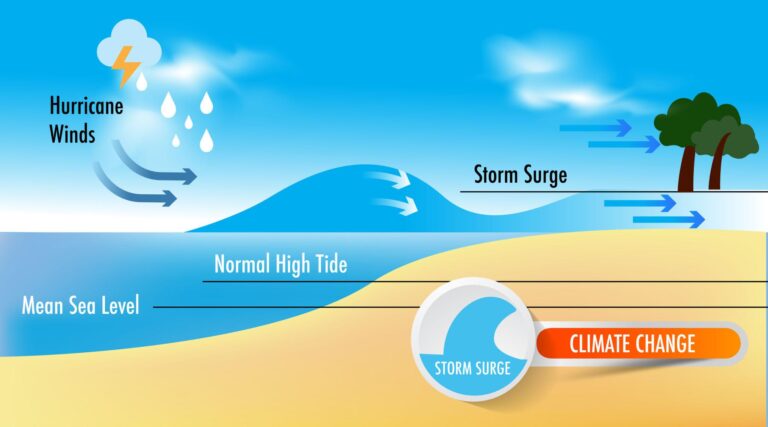
Climate change increases the intensity of these systems because warmer air holds more water vapor. For every 1 degree Celsius of warming, the atmosphere can hold about 7% more moisture. This leads to atmospheric rivers that are wetter, longer, and more likely to cause extreme flooding.
Are all atmospheric rivers dangerous?
No, the majority of these events are weak to moderate and are beneficial for the environment. They provide the necessary water for forests, agriculture, and municipal water supplies. Only the high category events (4 and 5) typically result in significant damage.
Conclusion
Atmospheric rivers are a fundamental component of the Earth’s climate system, serving as the primary mechanism for moisture transport across the globe. As our planet warms, the volatility of these systems will increase, presenting a clear challenge to infrastructure and public safety. By investing in advanced forecasting, reforming water management policies, and embracing nature-based solutions, we can mitigate the risks while capturing the vital water these “rivers in the sky” provide.
The time to act is now. Policymakers and citizens must prioritize climate resilient infrastructure to ensure our communities can withstand the next major landfall. Stay informed on local climate projections and support initiatives that promote sustainable water management in your region.