
Imagine a world painted in invisible currents, where air dances and water sways to the rhythm of Earth’s grand atmospheric orchestra. This isn’t some cosmic symphony playing behind the scenes; it’s the very air we breathe, the wind that whispers through your hair, the rain that nourishes the earth. Today, we’ll grab our raincoats and wind instruments, because we’re diving headfirst into this fascinating ballet of wind and water:
Table of Contents
TogglePrecipitation: Nature’s Rain Dance:
Ever wondered why clouds cry sometimes? It’s all about precipitation, the fancy way of saying “rain, snow, hail, or anything else falling from the sky.” When warm, moist air rises, it cools down, condensing those invisible vapor tears into tiny droplets that eventually become the pitter-patter on your umbrella. Clouds are just fluffy storage units for all this liquid drama, each type (like puffy cumulus or wispy cirrus) holding its own precipitation potential.
Westerlies: Wind’s Global Highway:
Think of Earth as a giant spinning ball (it is, trust me). As it spins, the Coriolis effect (a fancy way of saying “Earth’s rotation gives things a little twist”) kicks in, creating these dominant westerly winds that blow from west to east around the globe. They’re like the main highways in the upper atmosphere, guiding everything from weather systems to migrating birds.
Local Winds: A Neighborhood Breeze:
But wait, there’s more! Not all winds follow the “west is best” motto. Local winds, like sea breezes and mountain winds, are like chatty neighbors gossiping about the weather over coffee. They’re influenced by local geography, temperature differences, and even that steaming cup of joe you just brewed. These winds can be gentle whispers or blustery brawlers, always adding a touch of personality to the atmospheric scene.
Cirrocumulus: The Ceiling of Your Day:
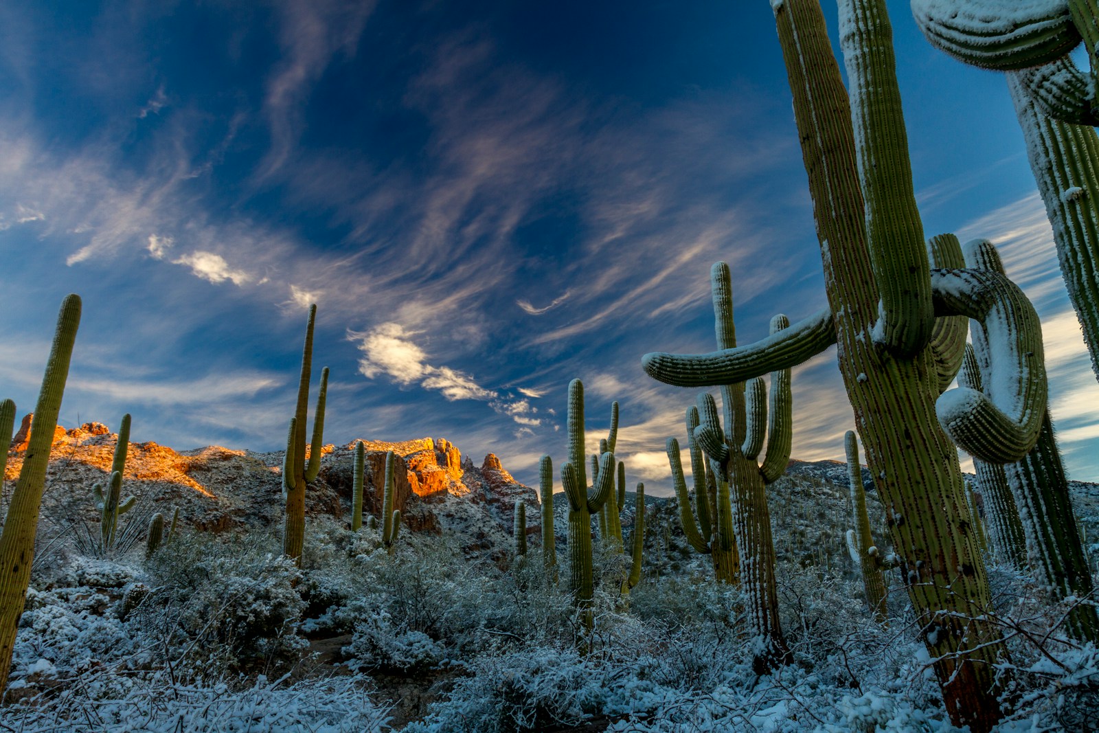
Look up! Do you see those tiny, white puffs like cotton candy scattered across the vast blue canvas? Those, my friend, are cirrocumulus clouds, and they’re often a signal that fair weather is on the horizon. They hang out near the top of the troposphere (Earth’s atmospheric layer where most weather happens), like fluffy guardians watching over the planet.
Subtropical Jet Stream: The Speedy Sky Serpent:
Ever heard of the subtropical jet stream? Imagine a fast-moving ribbon of air in the upper troposphere, zipping around the globe like a celestial serpent. This jet stream plays a crucial role in steering weather systems, guiding storms, and influencing everything from droughts to heat waves. Think of it as Earth’s weather conductor, orchestrating the movement of air masses and precipitation.
Jet Stream Symphony: What Makes Them Sing?
But what makes these atmospheric serpents dance? It’s all about temperature differences! Warm air loves to rise, while cold air prefers to sink. This creates pressure gradients, pushing and pulling the jet streams like invisible strings. And guess what else adds drama to the mix? Ocean currents! Cold currents like the Humboldt Current can weaken the jet stream, while warm El Niño currents can supercharge it, leading to unpredictable weather patterns.
Occluded Front: The Weather Detective’s Clue:
Have you ever seen a weather map with weird squiggly lines and symbols? Those are fronts, boundaries between air masses with different temperatures and pressures. And when two fronts collide, like a detective story gone windy, an occluded front is born. These bring heavy precipitation and stormy weather, a dramatic twist in the atmospheric play.
Trade Winds: The Ancient Air Sailors:
Think about those adventurous explorers who crossed oceans in sailing ships centuries ago. They relied on powerful, steady winds called trade winds. These winds blow from high-pressure zones near the tropics towards the equator, like loyal companions guiding ships across the waves. They’re also responsible for driving ocean currents, shaping climates, and even influencing global wind patterns.
Jet Stream Magnets: What’s Drawn to the Current?
The jet stream isn’t a lonely traveler. It attracts smaller weather systems like moths to a flame. These systems, called upper-level troughs and ridges, ride along the jet stream, influencing local weather patterns and adding even more complexity to the atmospheric dance. It’s like a celestial ballet with constantly changing formations and unpredictable pirouettes.
Ocean Currents: Earth’s Liquid Highways:
The atmosphere isn’t the only player in this grand show. Ocean currents, like giant conveyor belts of water, flow around the globe, transporting heat, nutrients, and even influencing weather patterns. The mighty Gulf Stream, for example, brings warm water from the tropics towards Europe, keeping its winters milder. These currents are the silent partners in the atmospheric play, shaping climates and influencing everything from the geosphere to the atmosphere.
Coriolis Caper: The Twist of Fate:
Remember the Coriolis effect, the mischievous force that gives winds their signature swirl? It’s Earth’s rotation that makes winds “curve” to the right in the Northern Hemisphere and left in the Southern. This seemingly small twist has a profound impact on everything from the direction of prevailing winds like the trade winds to the formation of hurricanes. Imagine a spinning teacup, with the water swirling towards the edge – that’s the Coriolis effect in action!
Prevailing Winds: The Global Air Orchestra:
Speaking of prevailing winds, these are the dominant wind patterns that blow across the globe, like the reliable musicians in our atmospheric orchestra. The trade winds mentioned earlier, are a prime example, but there are others like the westerlies, the polar easterlies, and the monsoons, each with their own unique rhythm and influence on regional climates.
Cumulus: The Fluffy Storytellers:
Those fluffy white clouds we call cumulus aren’t just cotton candy in the sky; they’re like storytellers, giving us clues about the weather. When they puff up and tower like castles, they could be hinting at brewing thunderstorms. But when they stay scattered and playful, fair weather is likely on the horizon. Learning to read the clouds, like decoding a secret language, adds another layer of fascination to the atmospheric ballet.
Air Masses: The Traveling Weather Crews:
Imagine giant air parcels, each with its own temperature, humidity, and pressure, journeying across the globe like nomadic weather crews. These air masses, like the cold polar air masses or the warm, moist tropical air masses, clash and mingle, influencing weather patterns wherever they meet. When a cold air mass encounters a warm one, a weather front forms, like a dramatic stage separation in the atmospheric play.
El Niño and La Niña: The Climate Chameleons:
El Niño and La Niña aren’t just catchy names; they’re the ocean’s mischievous twins, influencing weather patterns worldwide. El Niño, the warm phase, brings wetter winters to North America and drier conditions to Australia. La Niña, the cool phase, flips the script, leading to droughts in some regions and floods in others. These ocean-atmosphere power couples are a constant reminder of the interconnectedness of our planet’s systems.
Polar Easterlies: The Chilly Counterpoint:
While the westerlies dominate the middle latitudes, the polar easterlies reign supreme near the poles. These cold, dry winds blow from east to west, like a chilly counterpoint to the swirling westerlies. They play a crucial role in maintaining the planet’s heat balance and influencing the movement of ice and snow in the polar regions.
Atmospheric Rivers: The Raging Rivers in the Sky
Forget mighty rivers carving paths through canyons; the real giants of the water cycle lurk unseen, flowing not through valleys but through the vast expanse of the sky. These are atmospheric rivers, titanic corridors of concentrated moisture hurtling across the globe, capable of unleashing torrential downpours and flooding that dwarf even the most fearsome earthly river.
Imagine a behemoth the size of the Amazon River, but not gurgling water, but vapor – enough water vapor to fill 150 Olympic-sized swimming pools every second. That’s the scale of an atmospheric river, a narrow band of air packing more moisture than any terrestrial waterway. These invisible serpents wind their way across the globe, often along the edges of high-pressure systems, carrying precious water from the tropics towards land.
Life-Giving Giants:
Don’t be fooled by their destructive potential; atmospheric rivers are the silent heroes of our planet. They deliver a significant portion of the freshwater to many regions, nourishing forests, replenishing rivers, and filling reservoirs. California owes much of its lush coastal greenery to these sky rivers, and even arid regions like the American Southwest experience life-giving bursts of precipitation thanks to their occasional visits.
The Fury Beneath the Beauty:
But like a calm river unexpectedly turning into a raging torrent, the beauty of atmospheric rivers can quickly morph into destructive fury. When these moisture-laden giants make landfall, they release their bounty in explosive bursts, often leading to catastrophic floods, mudslides, and landslides. California, again, bears witness to this power, with historic floods in 2017 and 2019 attributed to atmospheric rivers.
Predicting the Unpredictable:
Forecasting these sky rivers is no easy feat. Their size and intensity can change rapidly, and their paths can be erratic. However, advances in weather modeling and monitoring systems are improving our ability to track these watery serpents and predict their landfall, giving communities precious time to prepare for potential floods.
Climate Change: A Wrench in the System:
A worrying aspect of atmospheric rivers is their potential link to climate change. Warmer oceans hold more moisture, potentially fueling more intense and frequent sky rivers. This poses a significant challenge, as regions already prone to flooding could face even greater risks in the future.
Living with the Rivers in the Sky:
Atmospheric rivers are a powerful reminder of the interconnectedness of our planet. They are life-giving forces, capable of nurturing ecosystems and sustaining communities. But they are also forces of destruction, a testament to the raw power of nature. Understanding these sky rivers, studying their behavior, and preparing for their potential wrath is crucial to ensuring the safety and well-being of communities around the world.
So, the next time you gaze at the clouds, remember – there may be more than meets the eye. Look for the subtle clues, the elongated bands of moisture in the satellite images, and be aware of the silent rivers flowing invisibly above. After all, respecting the power of these giants in the sky may be the key to coexisting with their beauty and their fury.
The Curtain Never Falls:
This whirlwind tour of Earth’s atmospheric orchestra is just the beginning. From the intricate dance of air masses to the unpredictable whispers of the jet stream, the weather is a story that unfolds constantly, a breathtaking performance that never fails to captivate. So, the next time you feel the wind brush your face or watch a cloud drift across the sky, remember – you’re witnessing a masterpiece in motion, a symphony of wind and water, a testament to the magic of our planet’s atmosphere.
FAQs:
- What are some other types of clouds besides cumulus? There are many other cloud types, each with its own unique appearance and weather implications. Some common types include stratus, cirrus, nimbus, and altocumulus.
- How do humans affect the atmosphere? Human activities like burning fossil fuels and deforestation can contribute to climate change, altering weather patterns and global temperatures.
- Can we predict the weather with certainty? While weather forecasting has become increasingly accurate, predicting the weather with complete certainty is still impossible due to the complex interactions within the atmosphere.
- What are some resources for learning more about the atmosphere? There are many great resources available online and in libraries, including weather websites, educational videos, and books on meteorology and climate science.
- How can I stay informed about weather warnings and advisories? Many national weather services provide real-time updates and warnings through their websites, mobile apps, and local news broadcasts.
- How common are atmospheric rivers? Atmospheric rivers are relatively rare, with an average of four to five active at any given time. However, their impact can be immense, accounting for a significant portion of freshwater received by certain regions.
- What can communities do to prepare for atmospheric rivers? Implementing flood control measures, building resilient infrastructure, and establishing early warning systems are crucial steps communities can take to mitigate the potential damage caused by atmospheric rivers.
- Is there anything we can do to prevent atmospheric rivers? While complete prevention is not possible, mitigating climate change by reducing greenhouse gas emissions can potentially lessen the intensity and frequency of these events.
- Are there any resources for learning more about atmospheric rivers? Several resources are available online and in libraries, including the National Oceanic and Atmospheric Administration (NOAA), the American Geophysical Union, and research articles published in scientific journals.
- Can we track atmospheric rivers in real-time? Yes, advanced weather monitoring systems and satellite imagery allow us to track atmospheric rivers in real-time, providing valuable data for forecasting their potential impact.
Remember, the weather is a fascinating and ever-changing phenomenon, and understanding its secrets can help us appreciate the beauty and complexity of our planet. So keep exploring, keep learning, and keep looking up at the sky – the atmospheric orchestra is always playing!