Climate Change & Hurricanes: 9 Alarming Truths
Every hurricane season breaks records now. Here are 9 alarming scientific truths connecting climate change to the worst storms in American history.
Warmer Oceans Are the Fuel Behind Monster Storms
Hurricanes are heat engines powered by warm ocean water. The Gulf of Mexico has warmed 1.5°F since 1970 — supercharging storms that make landfall in Texas, Louisiana, Florida, and the Carolinas.
Storms Now Go From Tropical to Category 5 in Hours
Hurricane Michael jumped from Category 1 to Category 5 in just 36 hours before hitting Florida's Panhandle in 2018. Rapid intensification — 35+ mph wind speed gains in 24 hours — is now 40% more common.
Sea Level Rise Is Amplifying Storm Surge Destruction
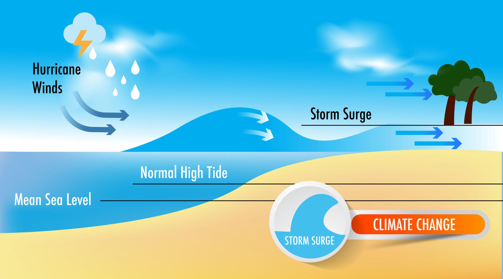
Every inch of sea level rise pushes hurricane storm surge further inland. Miami, Houston, Tampa, and New Orleans are all in the danger zone — and all have sunk in elevation while the ocean has risen.
Hurricanes Are Dropping More Rain — And Moving Slower
A warmer atmosphere holds more moisture, driving 15% more rainfall per hurricane. Harvey dumped 60 inches on Houston in 4 days — a 1-in-25,000 year event. Stalling storms, like Harvey and Florence, are 20% more common.
More Damage, Higher Costs, Longer Season
The US hurricane season has lengthened by 4 weeks since 1980. Category 4-5 storms are twice as likely now as in the 1970s. Total US hurricane damage has topped $1.3 trillion in inflation-adjusted costs.
All 9 Alarming Truths — With Science, Data & Sources
Our comprehensive analysis examines every facet of the climate-hurricane connection — from Atlantic basin dynamics to Gulf Coast flooding projections and what US communities must do to prepare.
Read the Full Analysis →