Table of Contents
ToggleIntroduction:
NASA’s Tropospheric Emissions: Monitoring of Pollution (TEMPO) mission has unveiled its first data maps, marking a significant step forward in understanding air pollution over North America. With a resolution comparable to a few square miles, TEMPO is the first instrument of its kind designed to continuously measure air quality from space. This article sheds light on the relevance of TEMPO’s data, its implications for decision-making, and its contribution to the Biden Administration’s climate agenda.
Unveiling North America’s Air Pollution Patterns:
TEMPO, positioned 22,000 miles above the equator, captures data on major air pollutants across North America. The instrument’s observations offer valuable insights into pollution caused by factors such as rush-hour traffic, forest fires, volcanic activity, and fertilizer application. By providing detailed information on pollutant concentrations, TEMPO aids in the evaluation of health impacts and the creation of neighborhood-scale air pollution maps.
Enhancing Understanding and Decision-Making:
TEMPO’s data has far-reaching implications for understanding disparities in air quality within communities. By collaborating with partner agencies such as the Environmental Protection Agency and the National Oceanic and Atmospheric Administration, TEMPO supports the monitoring and forecasting of air quality. Decision-makers can leverage these insights to devise effective strategies for improving air quality and mitigating the associated health risks.
TEMPO’s First Pollution Maps:
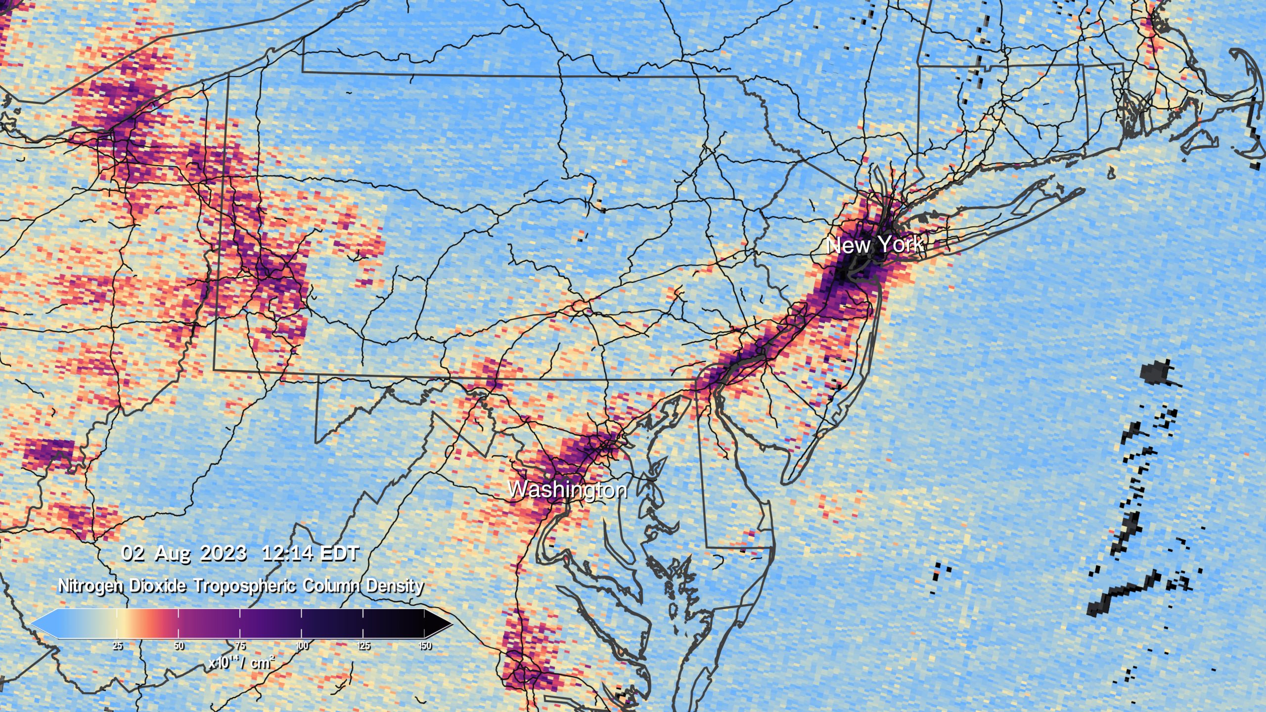
NASA recently released pollution maps generated by TEMPO, showcasing concentrations of nitrogen dioxide gas and revealing pollution hotspots around cities and major transportation routes in North America. These visualizations, based on scans conducted during TEMPO’s “first light” period, provide a glimpse into the instrument’s capabilities. The data collected during this period will be instrumental in approximately 50 planned scientific studies centered around TEMPO’s unique data collection methods.
Collaboration and Future Prospects:
The TEMPO mission is a collaboration between NASA and the Smithsonian Astrophysical Observatory. Built by Ball Aerospace and integrated with the Maxar-built Intelsat 40e satellite, TEMPO is part of NASA’s Earth Venture Instrument program. It complements other air pollution monitoring systems worldwide, such as South Korea’s Geostationary Environment Monitoring Spectrometer and ESA’s Sentinel-4 satellite, forming a virtual constellation of monitors for the Northern Hemisphere.
Conclusion:
NASA’s TEMPO mission represents a groundbreaking leap in monitoring air pollution over North America. With its space-based instrument, TEMPO provides crucial data that can inform decision-making, enhance pollution studies, and improve our understanding of air quality disparities. The release of TEMPO’s first pollution maps underscores its potential to revolutionize how we address air pollution and its impact on public health. By harnessing the power of space technology, TEMPO contributes to the realization of cleaner air and a healthier future.


